
These landscapes of Yukon-Charley Rivers National Preserve, situated in eastern Interior Alaska near the Canadian border, have remained the same for millenia. Han Athabaskan natives have hunted the tundra caribou and fished the Yukon salmon for most of that time. Below are a few aerial views of the varied landscapes and biomes that exist in the preserve.
The Seventymile River snakes its way through the taiga near its confluence with the Yukon.
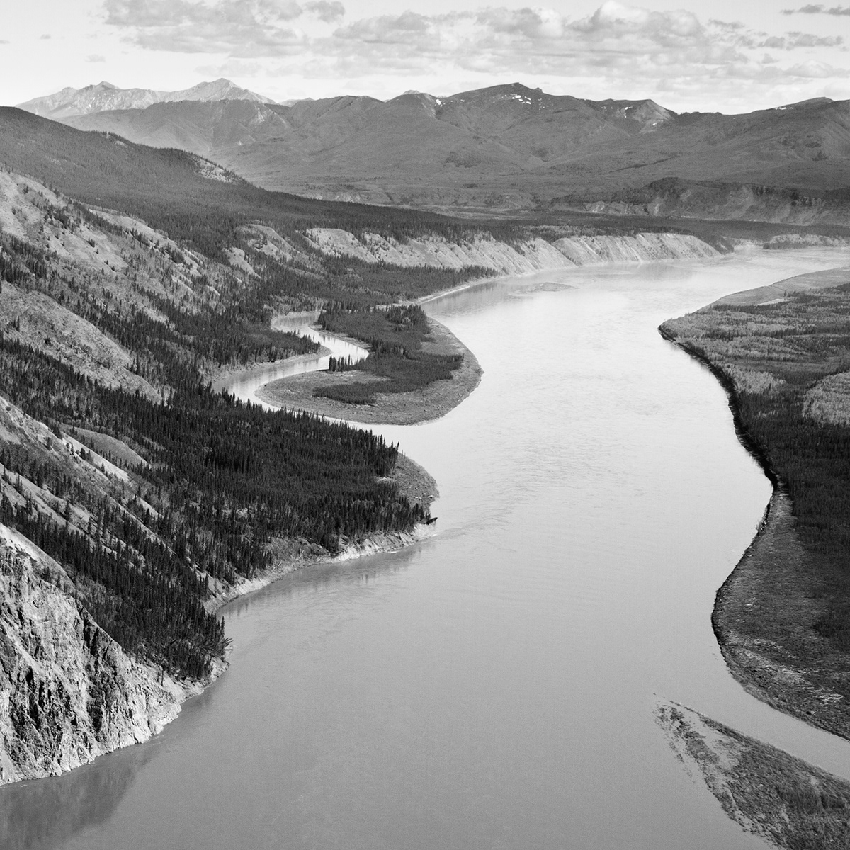
The enormous, silt-inundated Yukon River thunders past the border town of Eagle (pop. ~150). Nearly one ton of silt passes by Eagle every minute; the silt comes from glacial runoff in Canada's Yukon Territory.
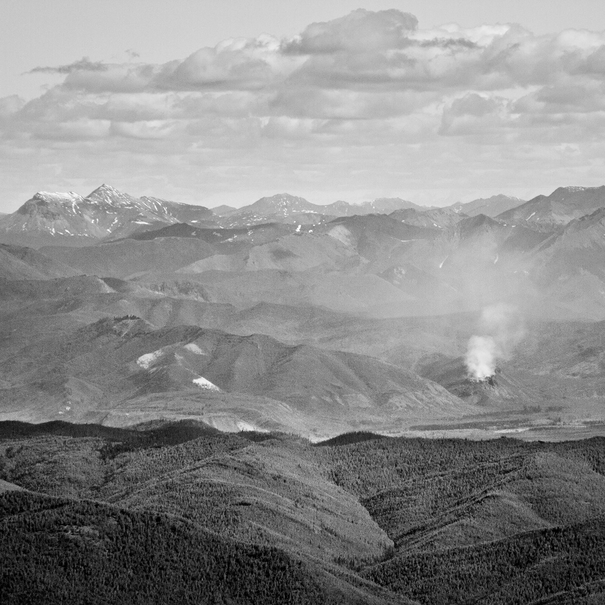
A wildland fire rages on a ridge on the north bank of the Yukon; in September 2012, a "major geological event" caused the explosion of a shale natural gas deposit. The top of the ridge was blown off, and the gas still burns to this day.
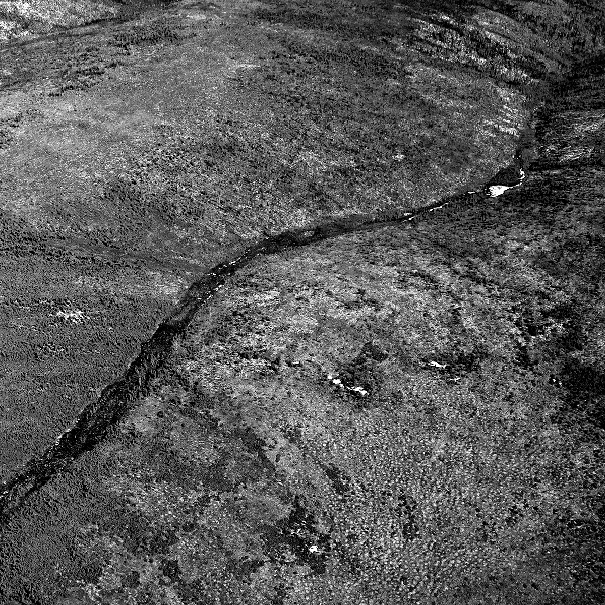
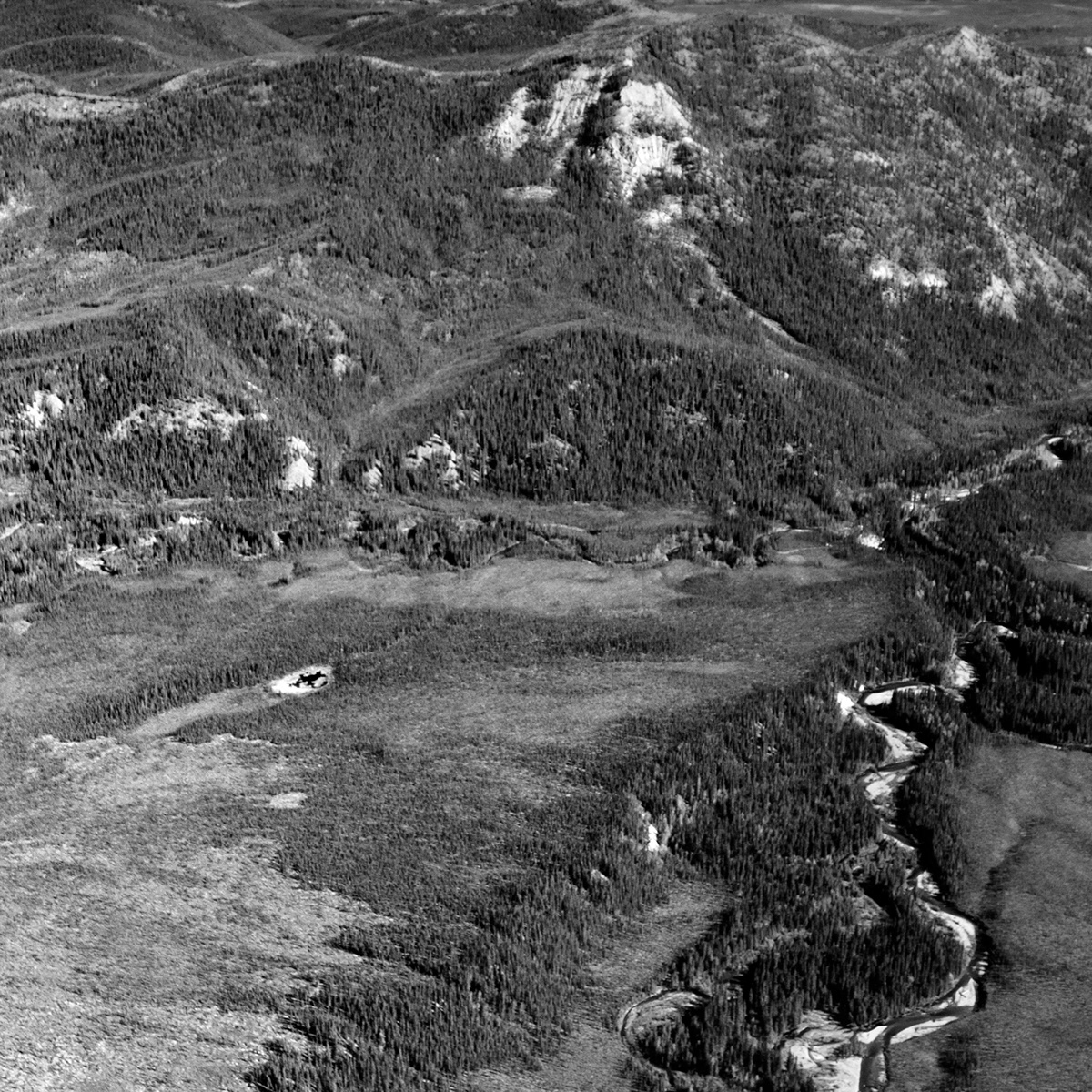
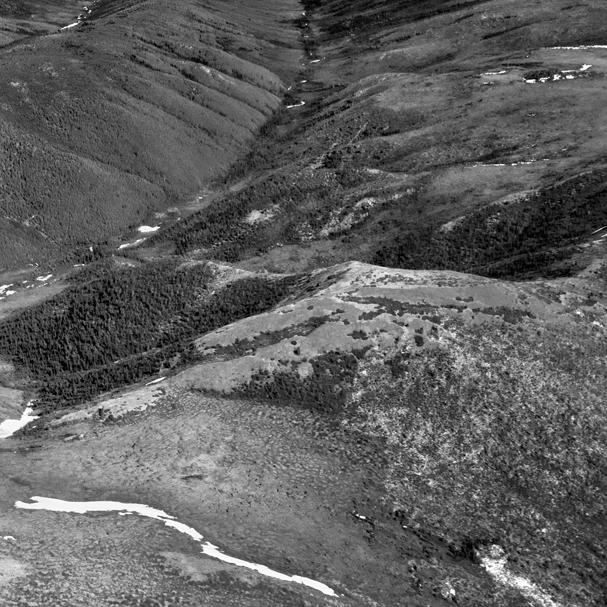
Boreal forest on the banks of the Yukon River gives way to taiga in the hills, which gives way to alpine tundra further west, in the uplands, around 3,000 feet of elevation. Permafrost does not allow draining water from snowmelt to seep into the ground; thus, the water runs along the ground, creating squelchy bogs and interesting designs in the short vegetation.
The Seventymile River gives rise to spruce growth along its banks.
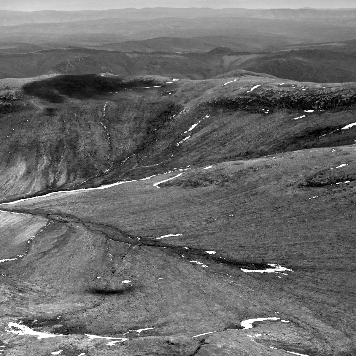
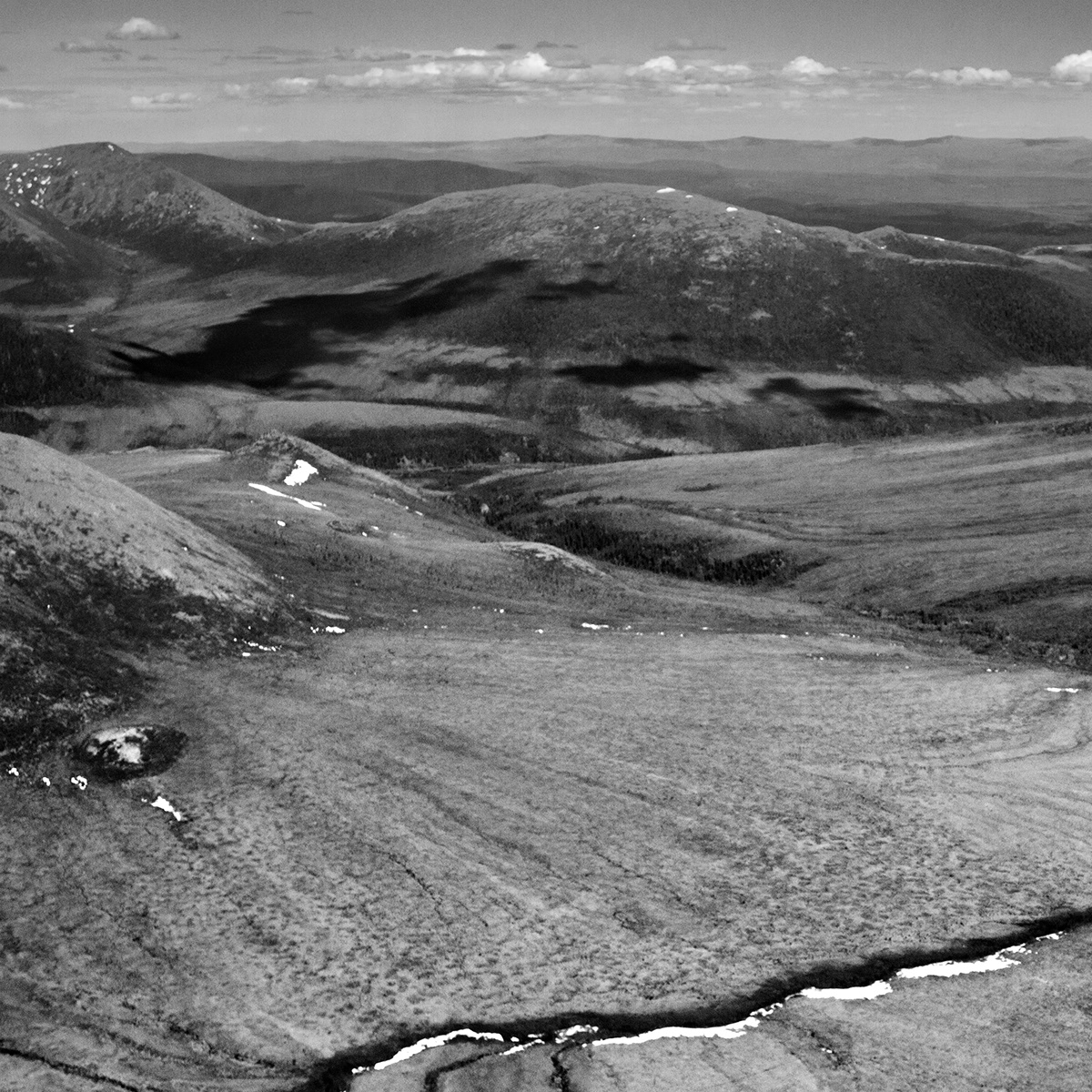
Alpine tundra dominates the uplands; some of the hidden pockets of snow in the crevices will not melt before next winter's snows.
Unnamed streams arise in valleys; gravity pulls water from snowmelt into every crevice. Most of it ends up in the enigmatic Charley River, which flows into the Yukon, which flows into the Bering Sea, which evaporates into cloud and snows back onto the mountains. And so the cycle continues.