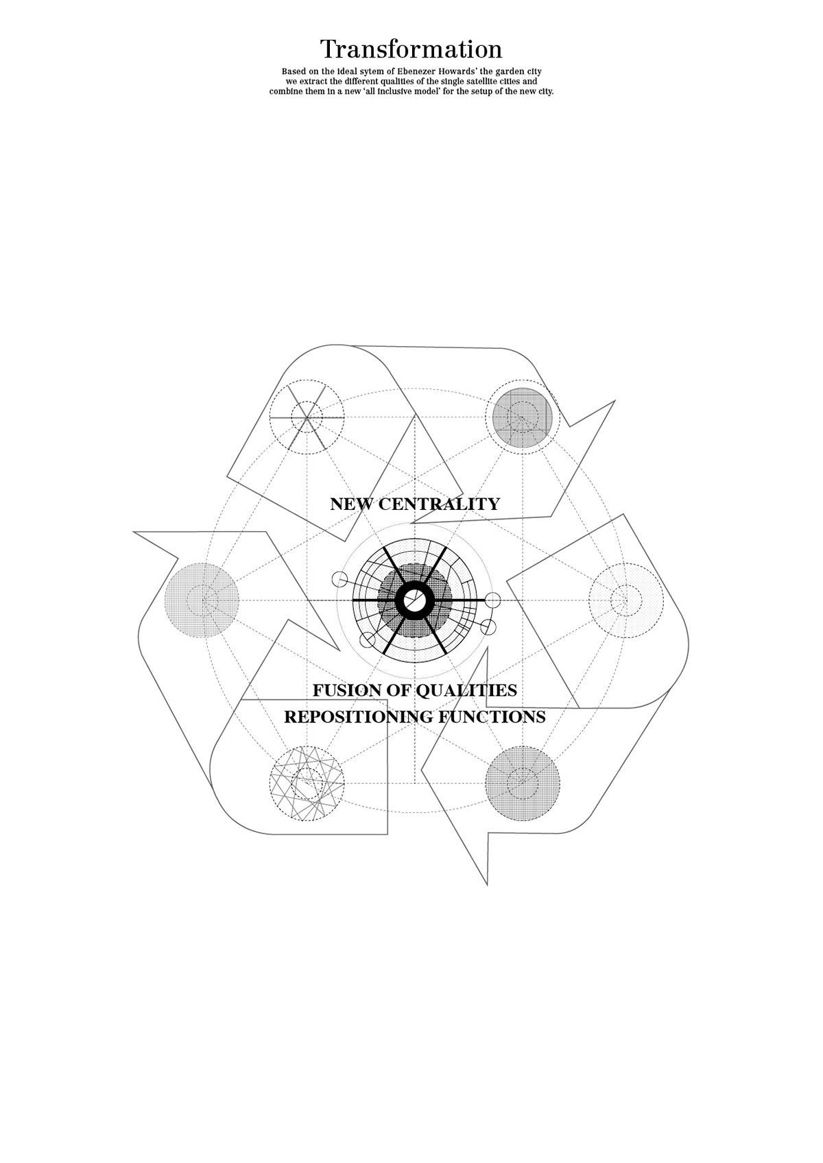
From fragments to centrality
some samples of a current project done at the ETH Zürich, together with Georgia Papathanasiou.
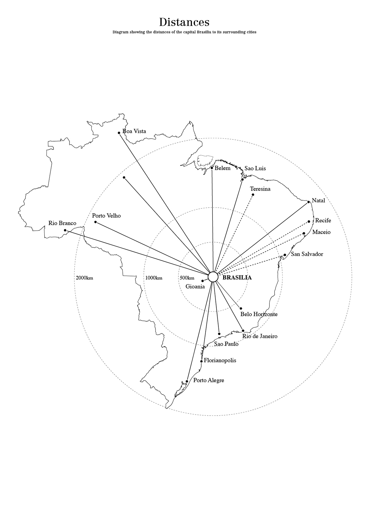
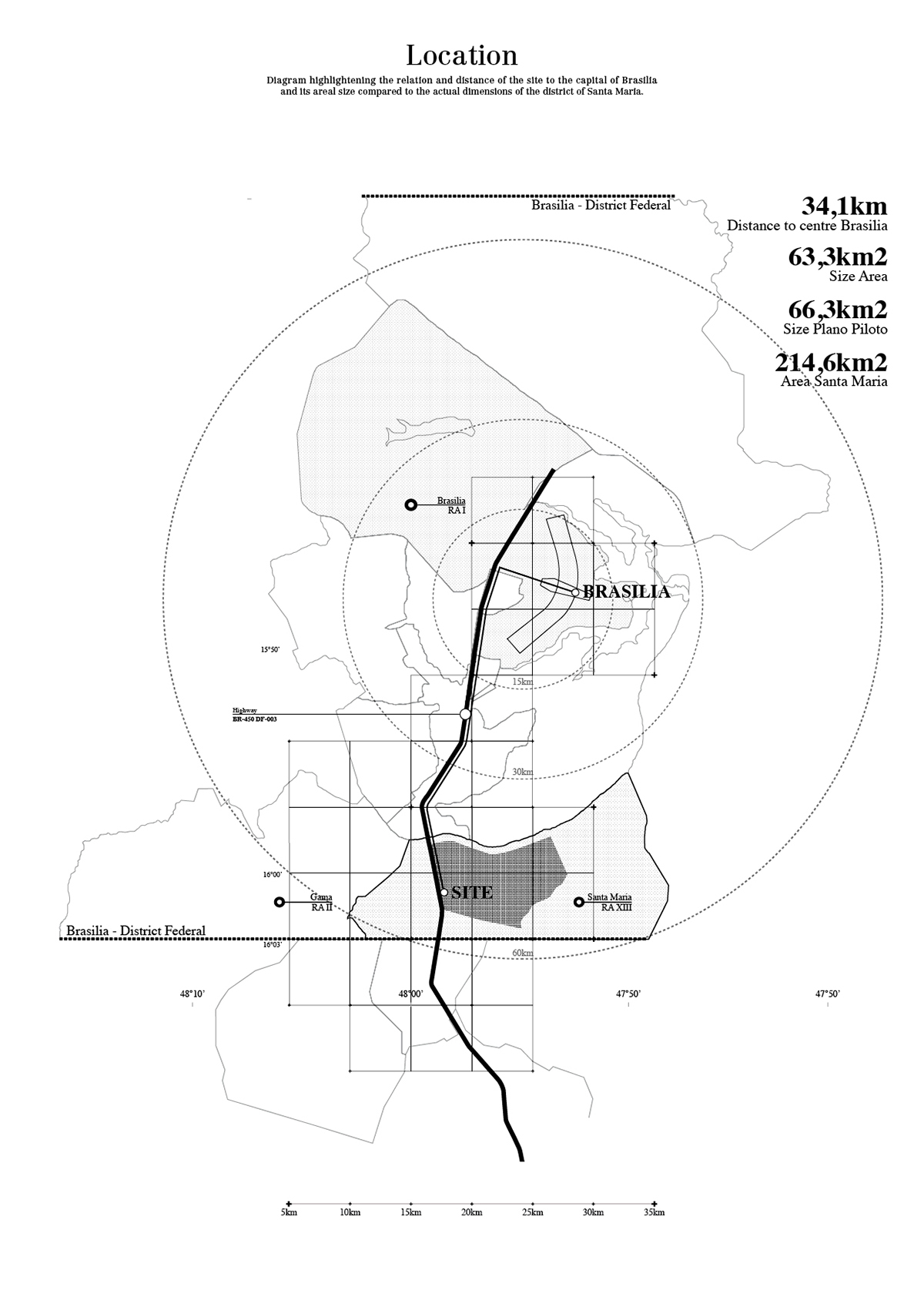
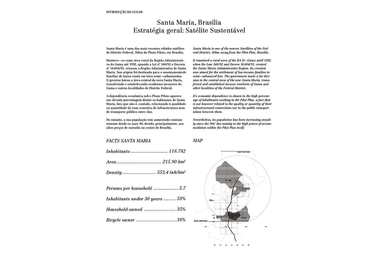
Located in Brazil, dealing with the topic of satellite cities around its capital Brasilia.
The main focus for the site in Brasilia will be on the organisation and creation of multiply centralities.
On one hand related to the use and introduction of transportations systems, as an alternative to the use of cars, on the other hand linked to the idea of zoning to establish networks to open up possibilities for a richer urban life, a mix of program and a more complex, divers urbanity.
Mobility—the goal is here to use and trace ‘hard’ infrastructure (street, pathways,..) as a starting point by installing facilities and ecological transportation systems, to activate the spaces and free them from the conventional image of the street scapes.
Creating dispersed centralities through modification of the relations between the private and the public / common spaces.
Challenging the tendency to segreation of the existing urban fabric in the satellites, it is attempted to distribute functions in a way to mobilize the area in the scale of the neighbourhood as well as in a regional scale.
The proposed centralities are meant to achieve a degree of autonomy and at the same time, to structure an urban layout that works as a whole.
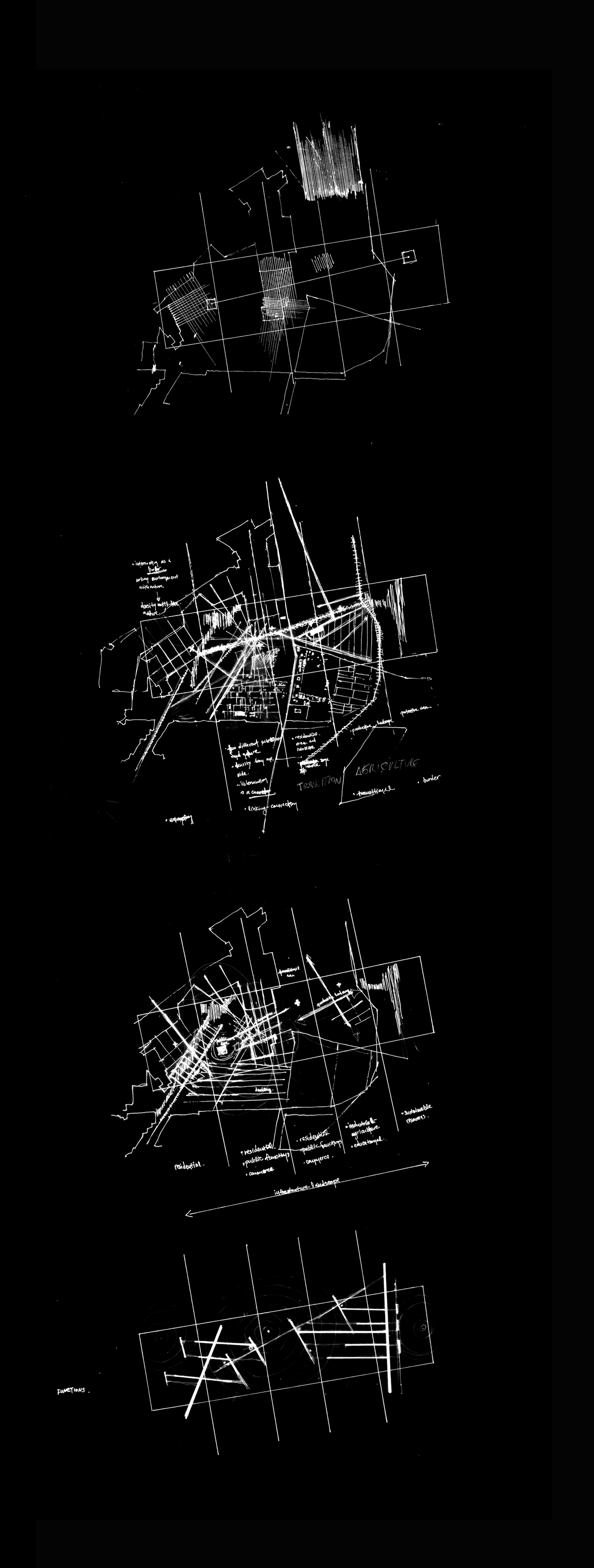
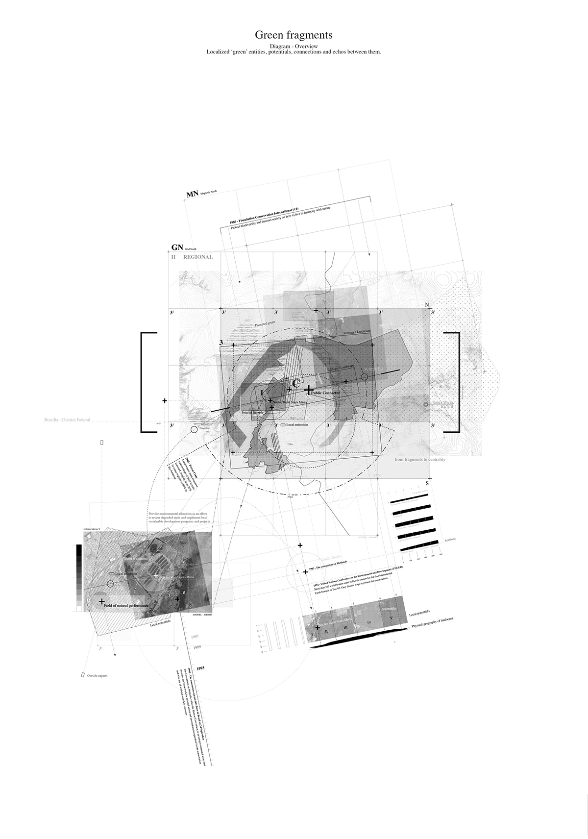
Identifying urban fragments
Introducing/Establishing new catalysts
new subcenters
new centralities
new connections
new conflicts
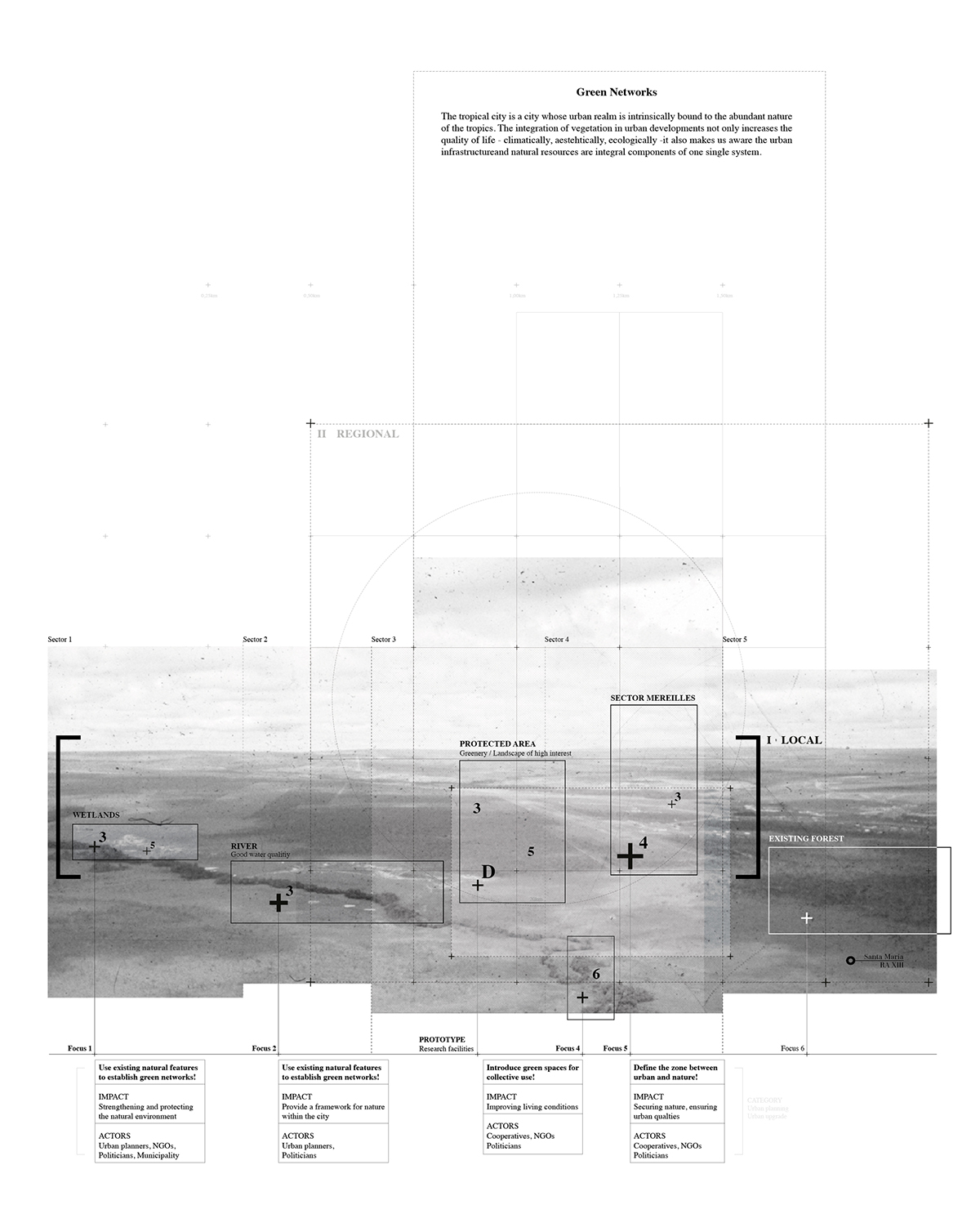
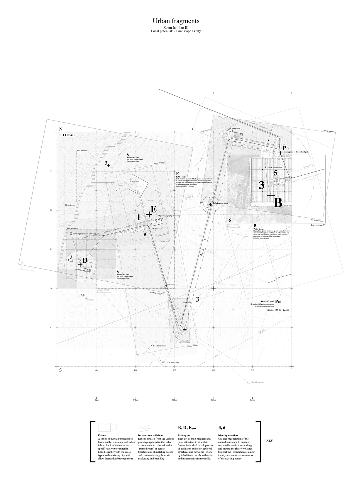
Extract of sketches - field and area of operation - ecology / landscape
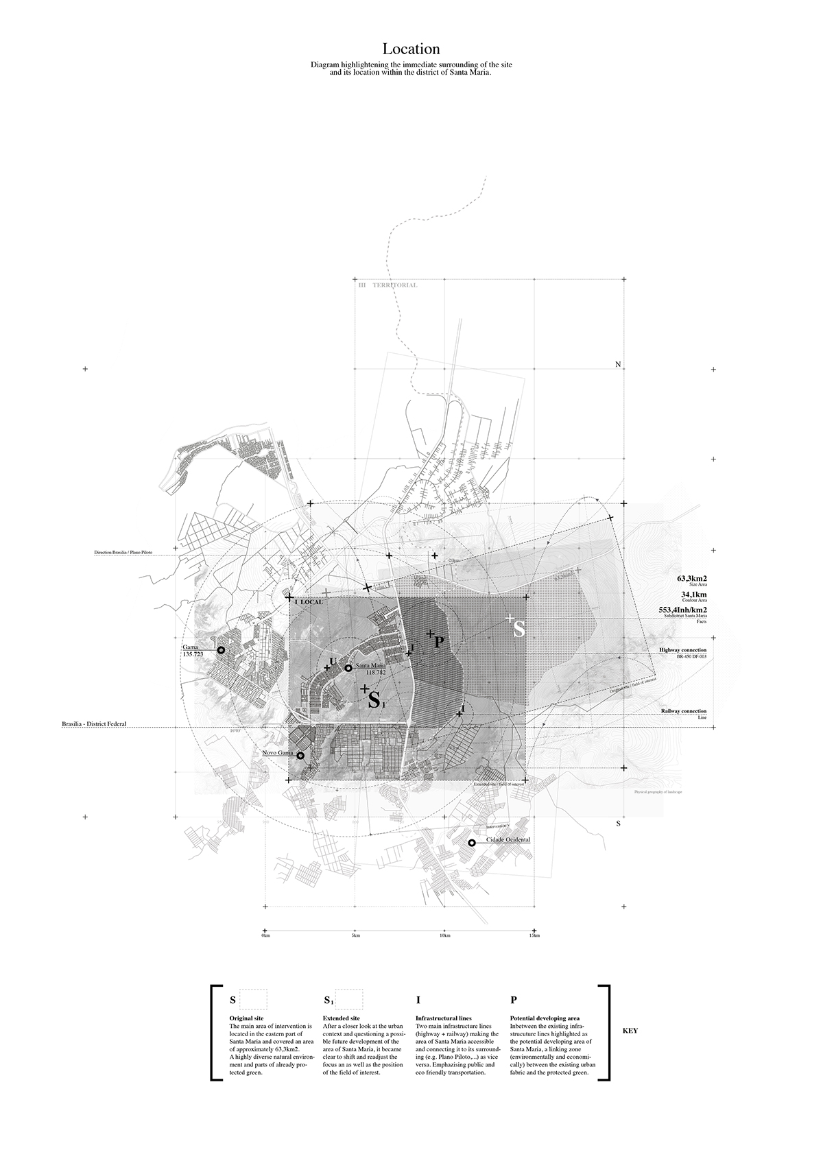

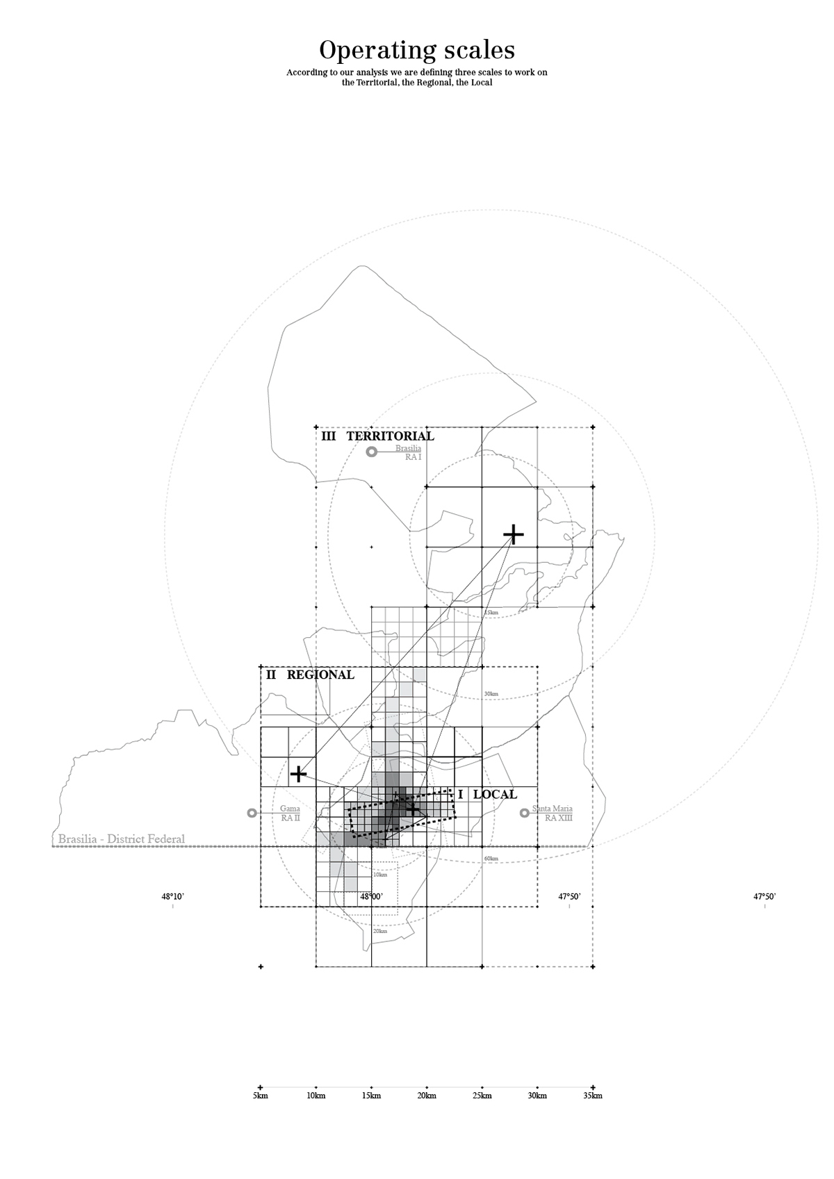
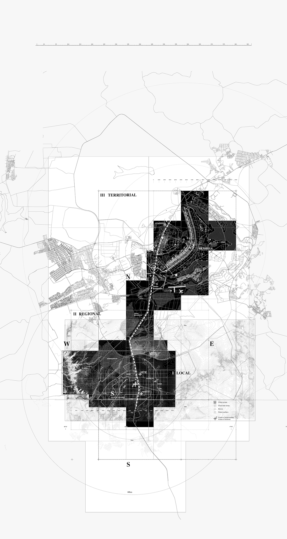
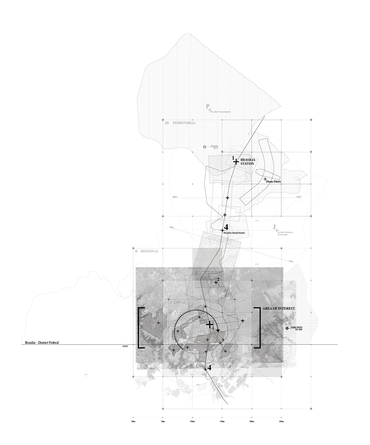
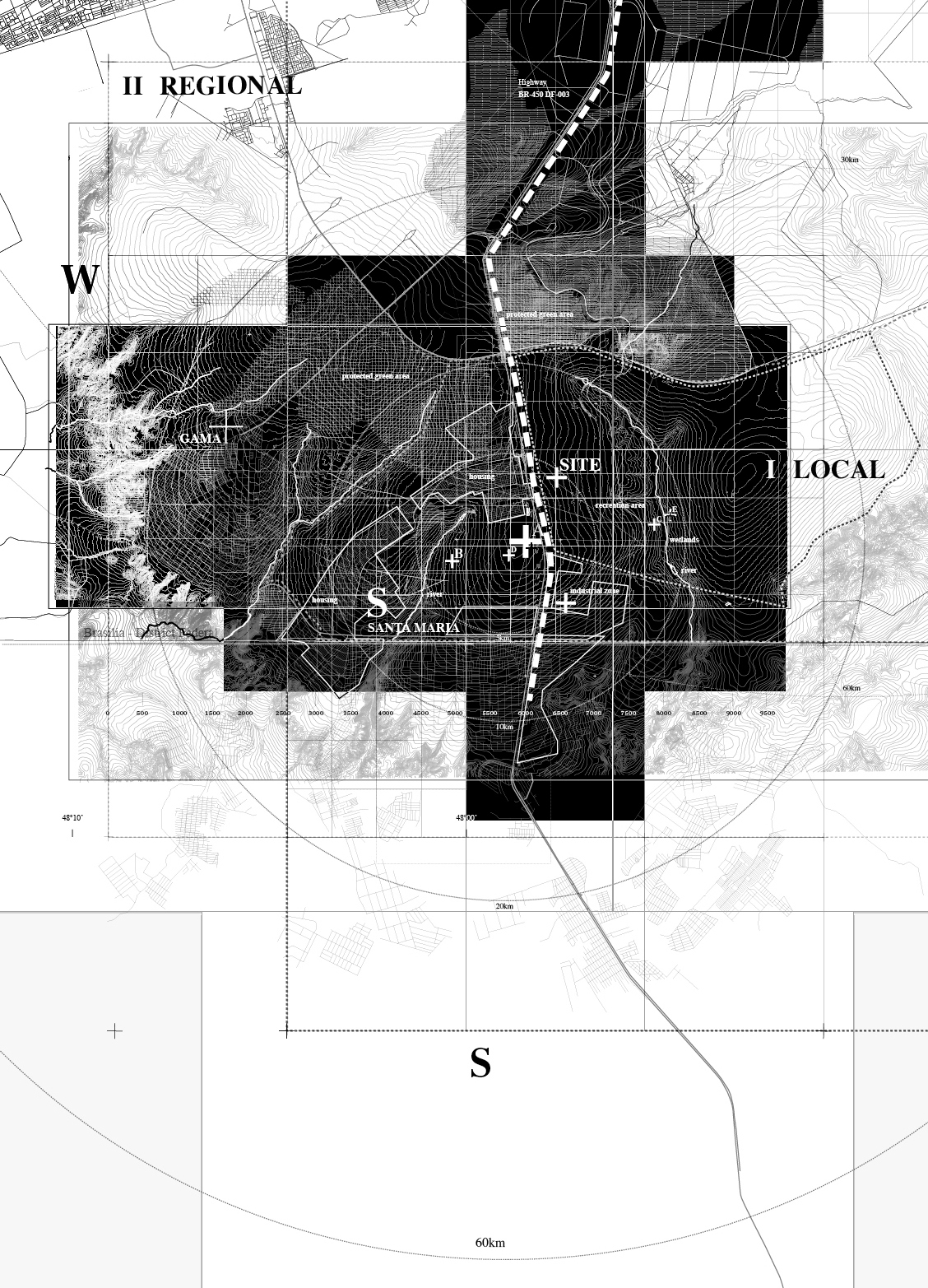
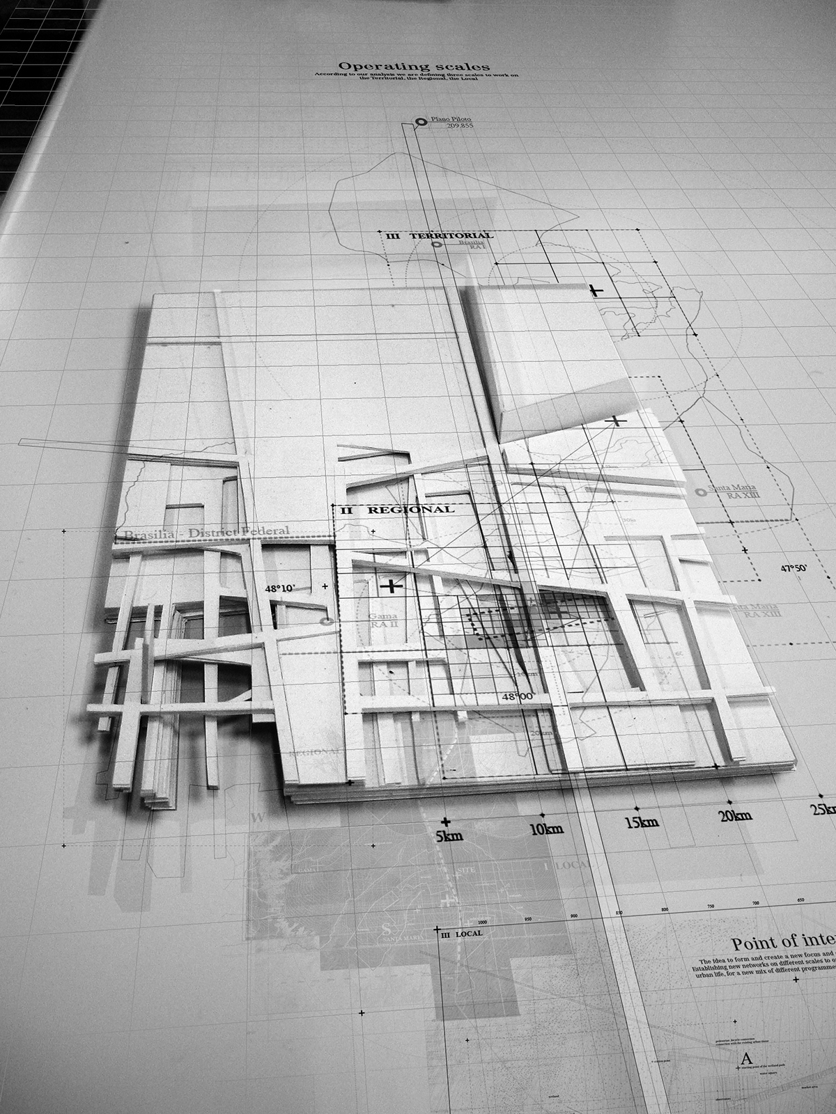
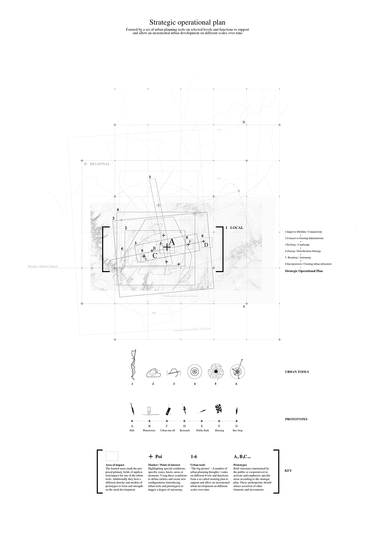
Area of interventions - 3 scales - territorial, regional, local
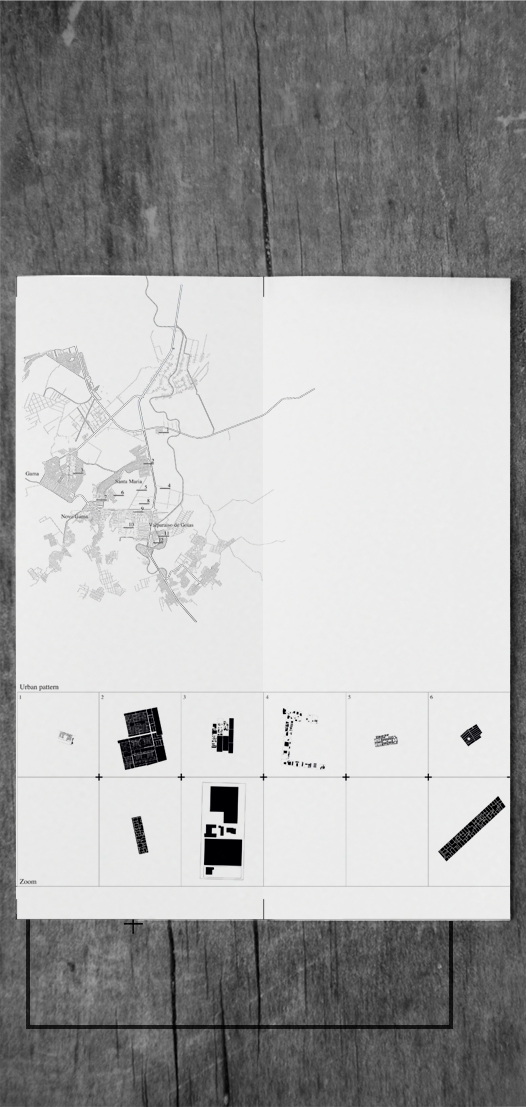
Typology Map
Analysis - mapping urban patterns
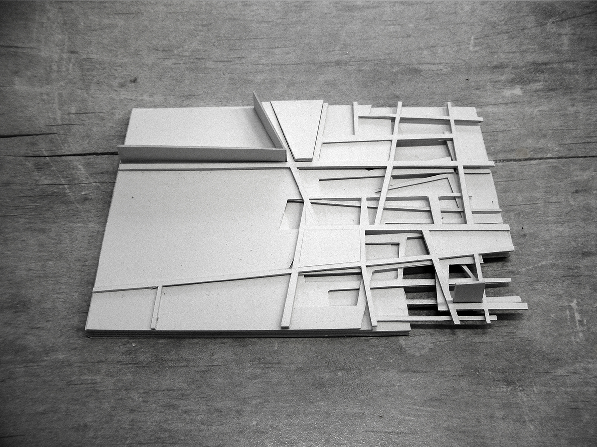
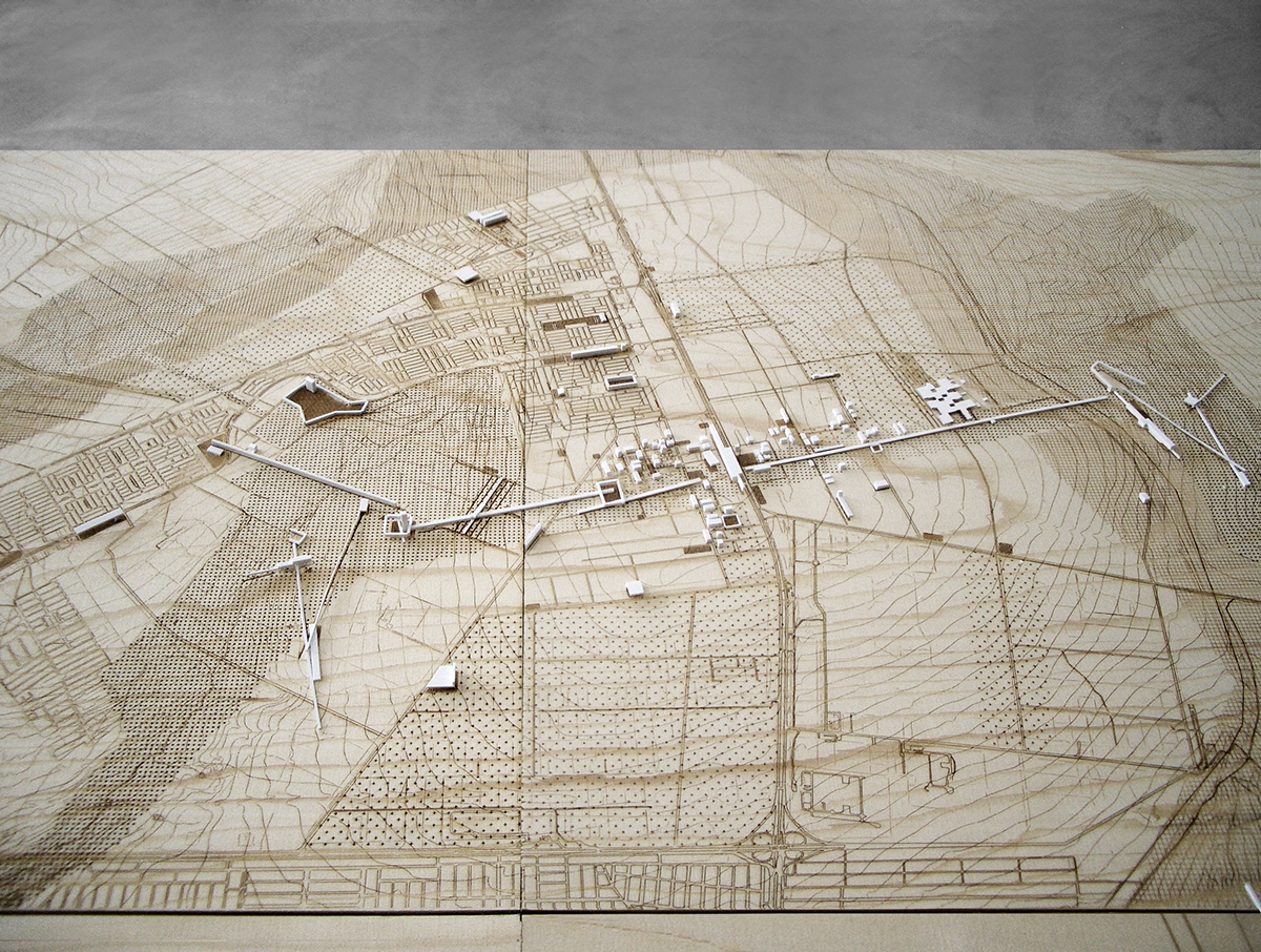
Concept model - different networks, grids and layers within a city
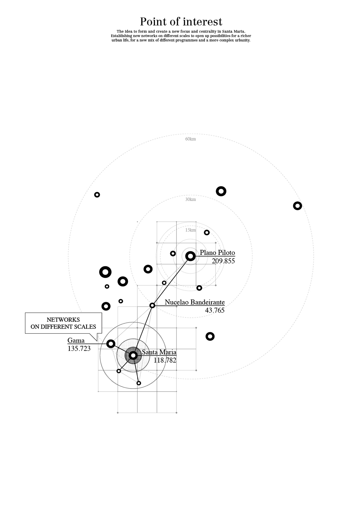
Points of Interest - Panoramic View
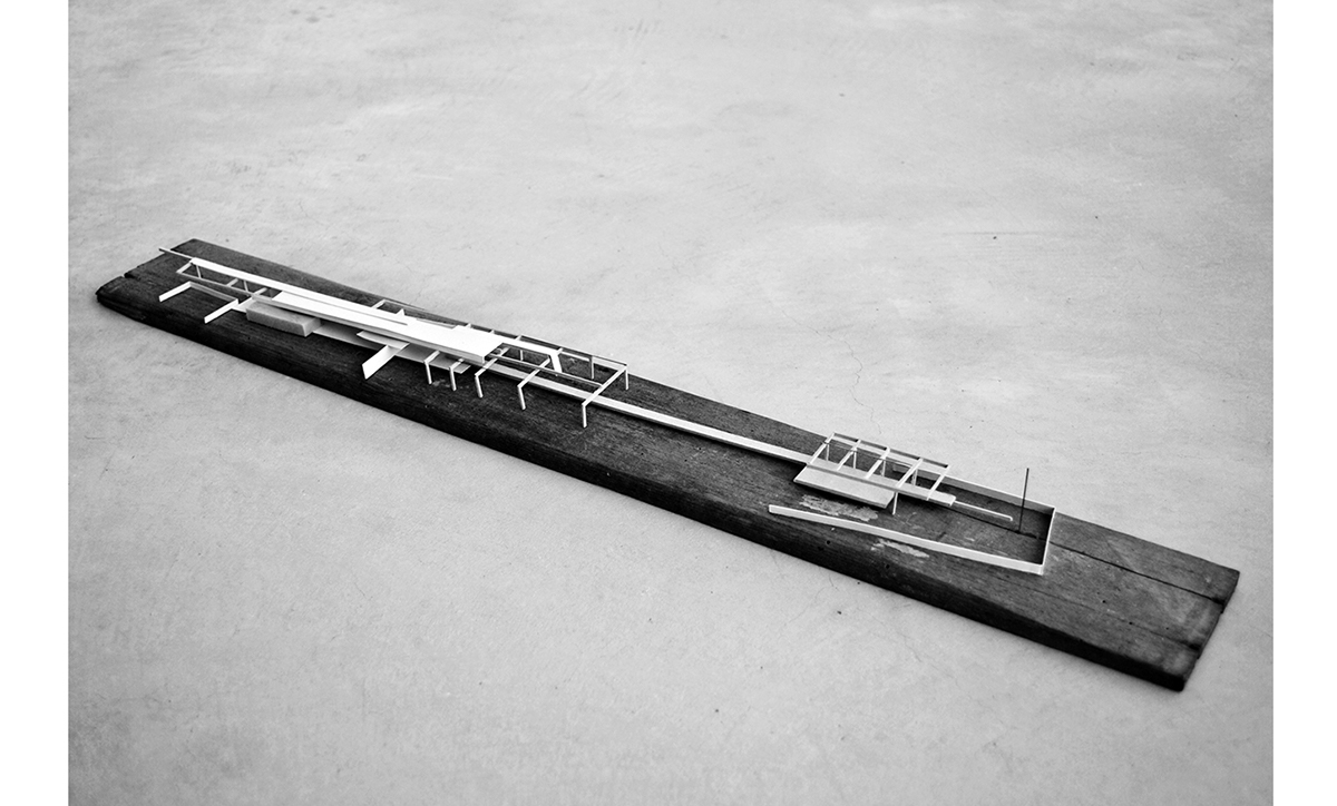
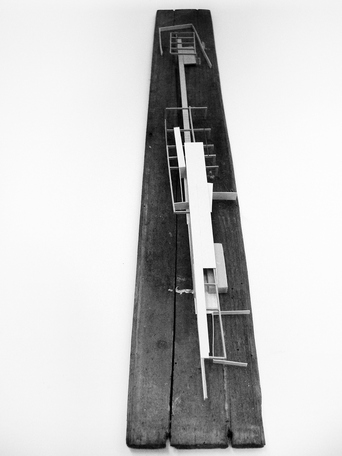
Prototype Research Facility
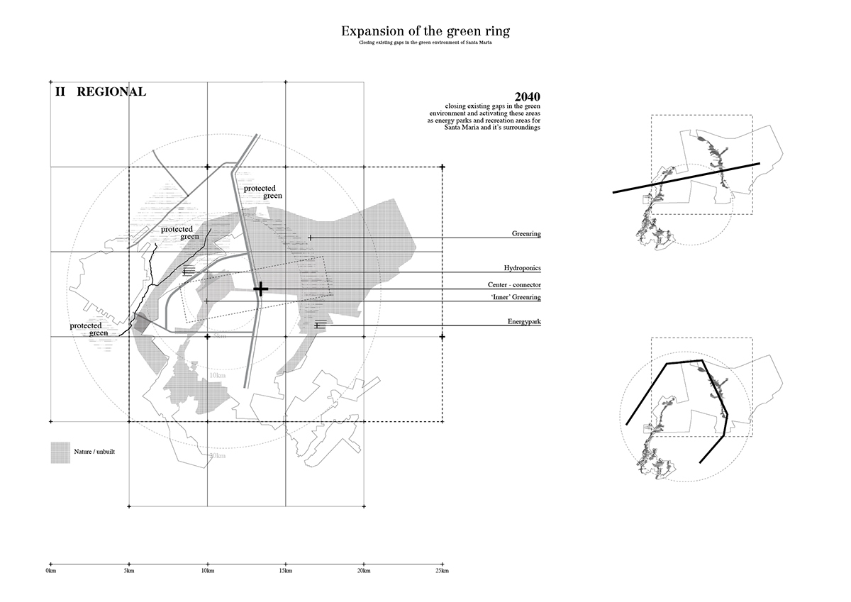
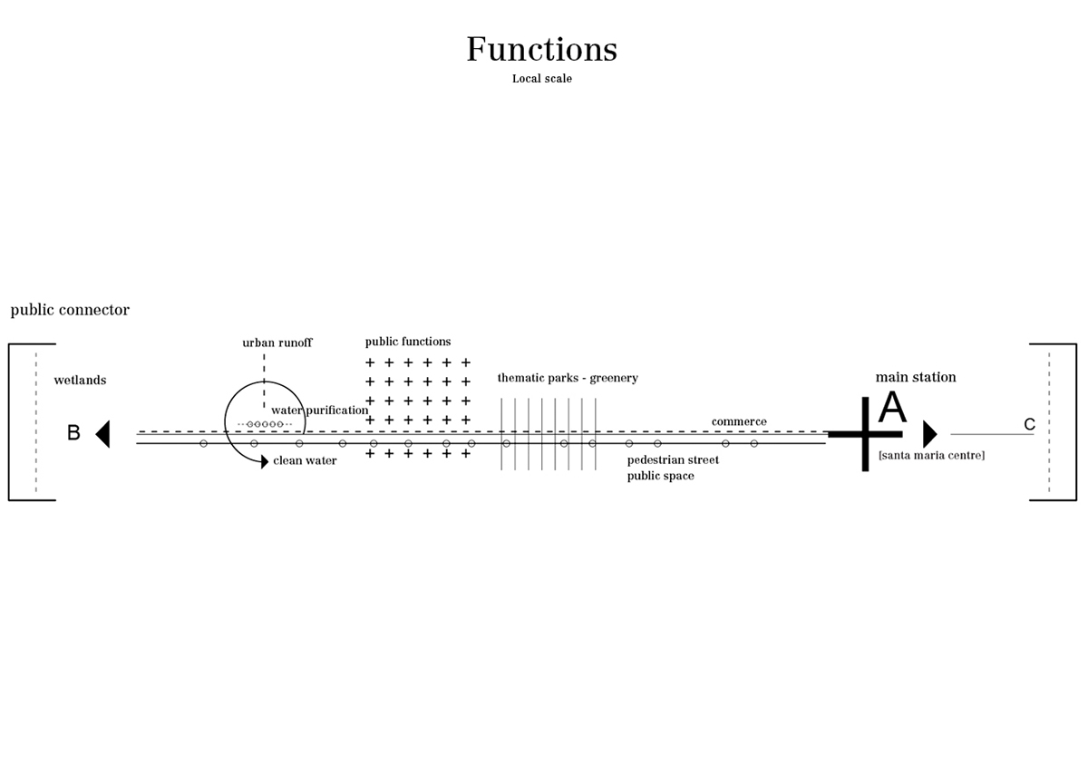
A green and public corridor attached with different kinds of facilities and functions connects the city center with the
existing wetlands and recreation area (1st phase) as well as the protected landscapes around Santa Maria (2nd phase).
existing wetlands and recreation area (1st phase) as well as the protected landscapes around Santa Maria (2nd phase).
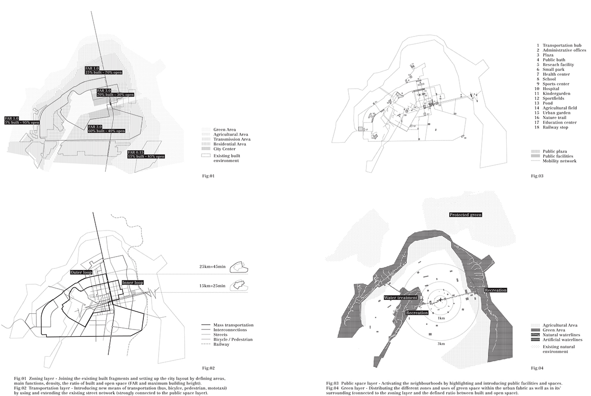
Urban tools
Fig.01 - Zoning - Fig.02 - Transportation layer - Fig.03 - Public space layer - Fig.04 - Green layer
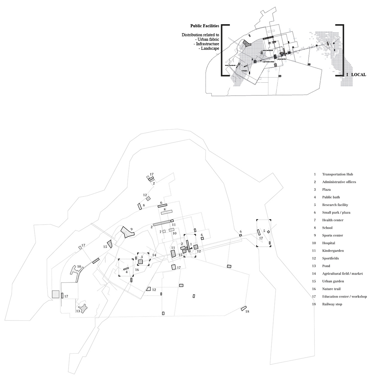
Overview Public Facilities - Phase I-III
Strategic plan - interventions, phase I
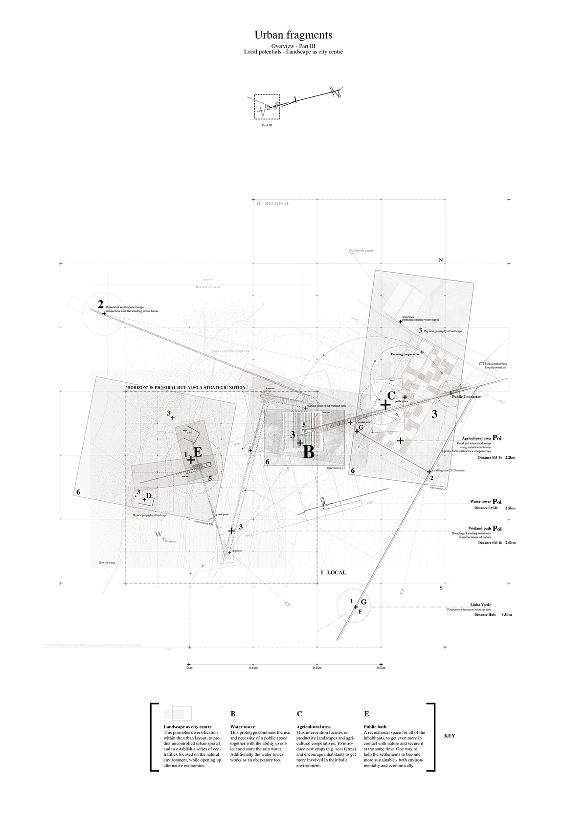
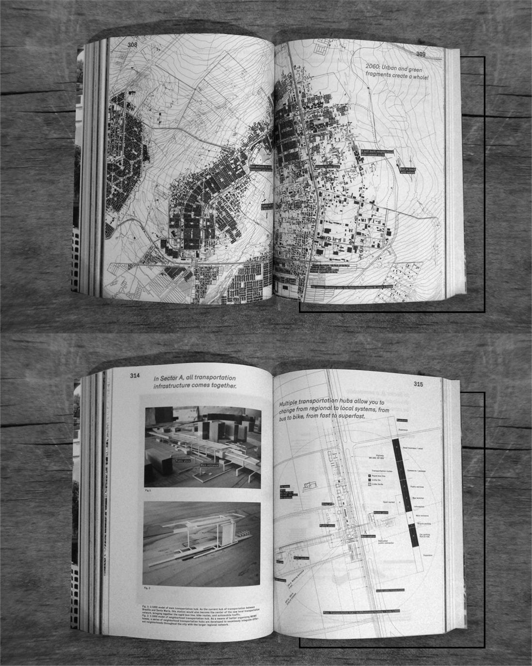
Over time urban and green fragments create a whole!

Access to Centralities
Providing access to centralities does not only mean connecting a city's dwellers with urban centers, but also ensuring that mobility is achieved
in a sustainable way. Centralities can be defined as local attractors (e.g. civic center, local commercial districts, spaces for leisure and sports,...)
as well as anchor points pertaining to the city as a whole.
Access therefore inevitably requires a diversified and open urban network.
in a sustainable way. Centralities can be defined as local attractors (e.g. civic center, local commercial districts, spaces for leisure and sports,...)
as well as anchor points pertaining to the city as a whole.
Access therefore inevitably requires a diversified and open urban network.
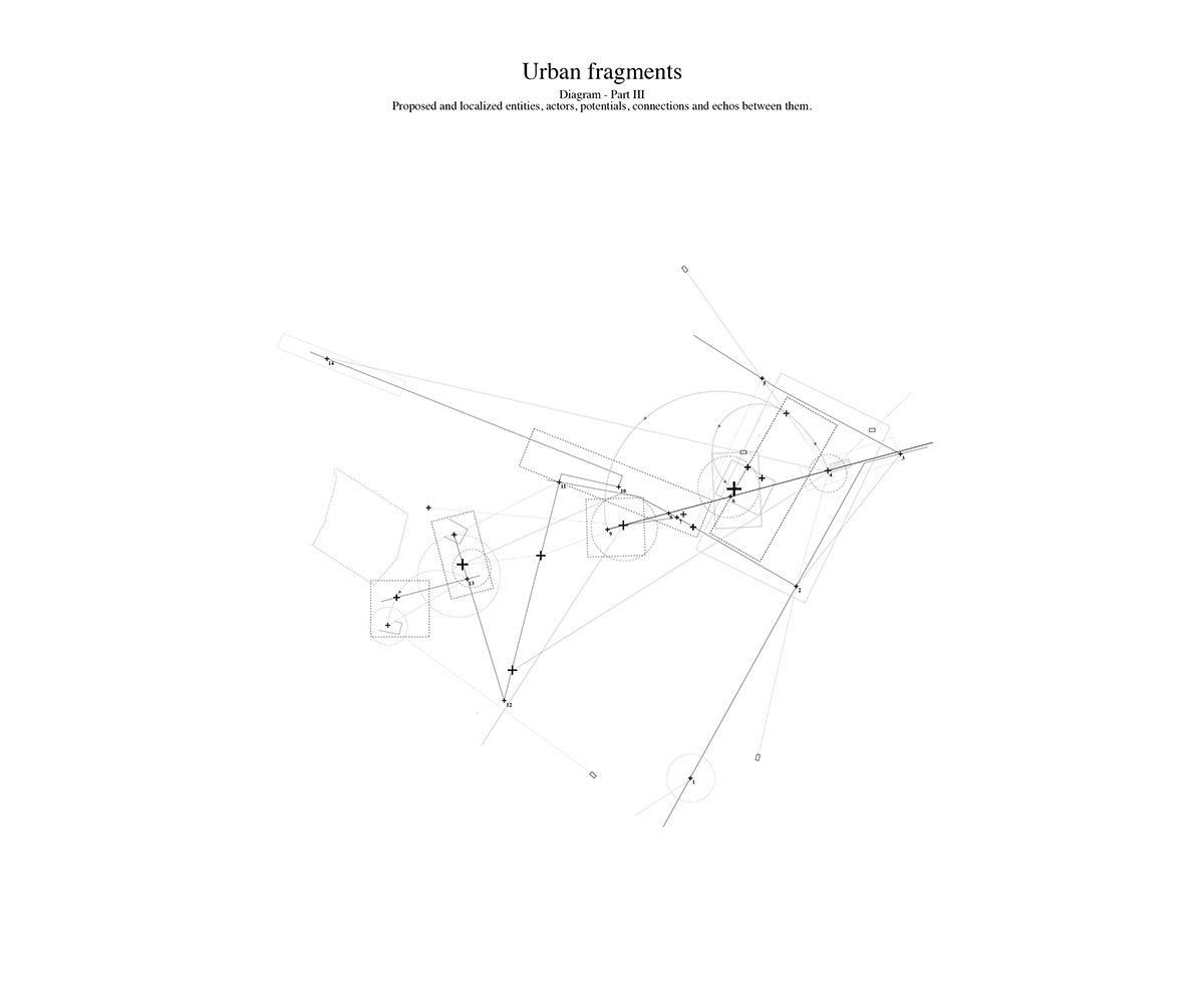
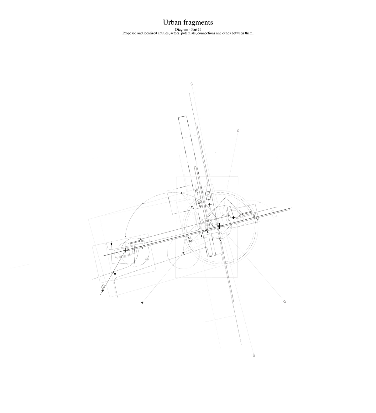
Relational mapping
Identifying entities, connections (echoes), points of departure, areas of influence...
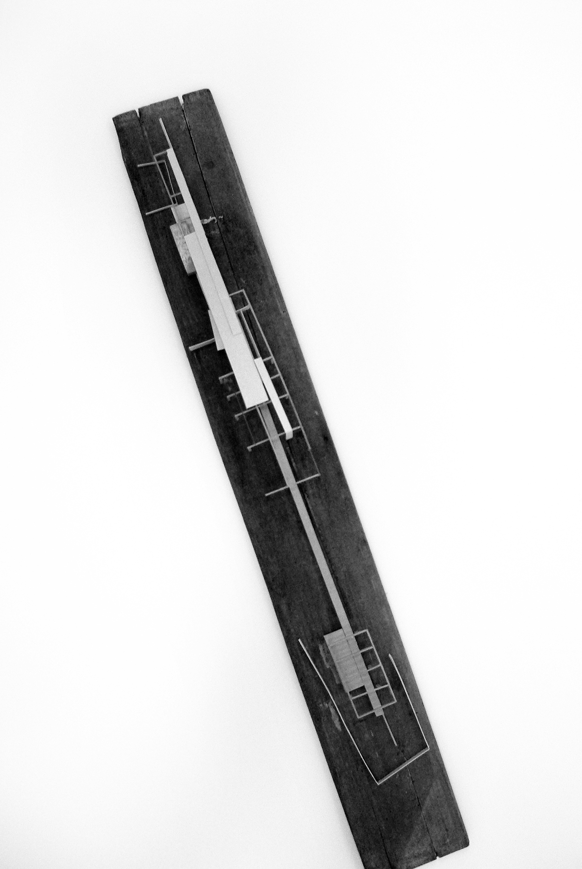
Prototype Research Facility
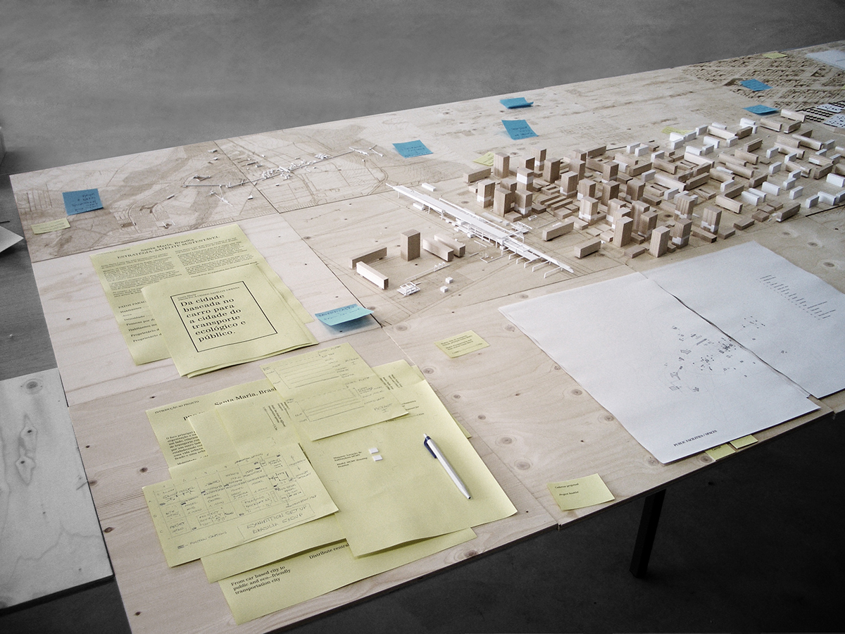
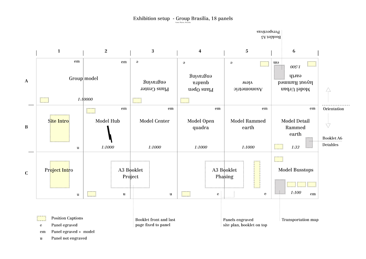
First test exhibition setup
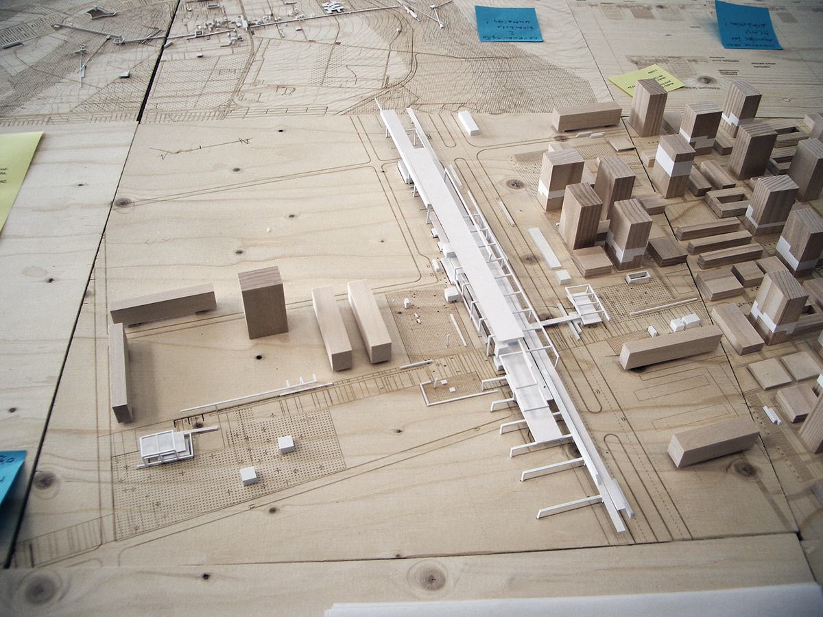
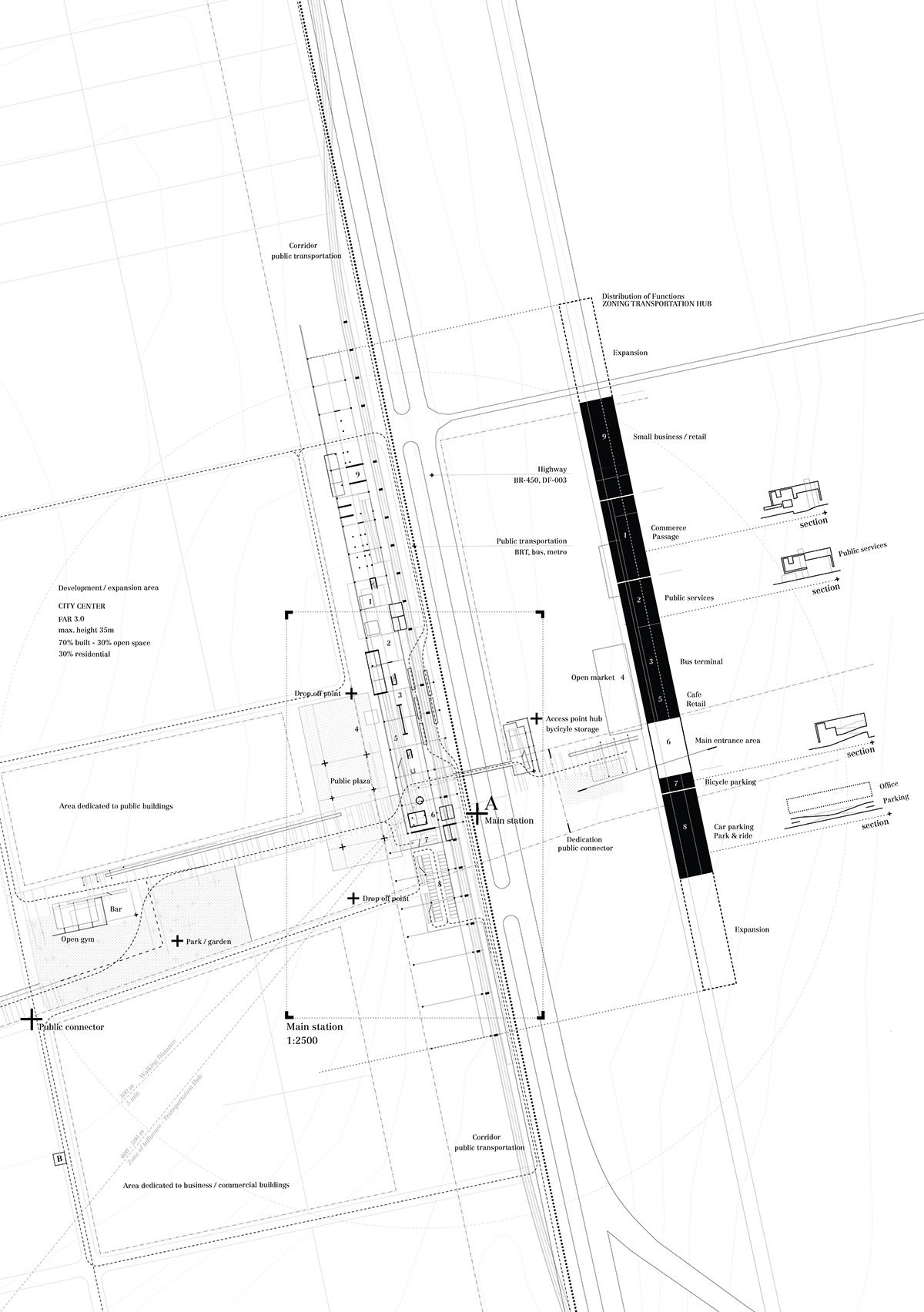
Transportation hub - the multifunctional building is hosting next to different means of transportation,
administrative facilities and departments for the municipality and citizens of the area of Santa Maria
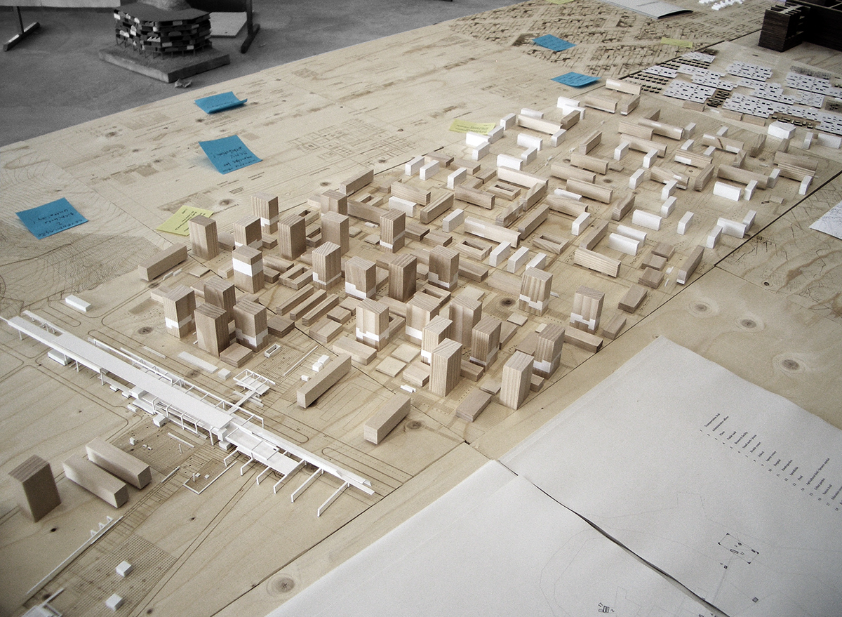
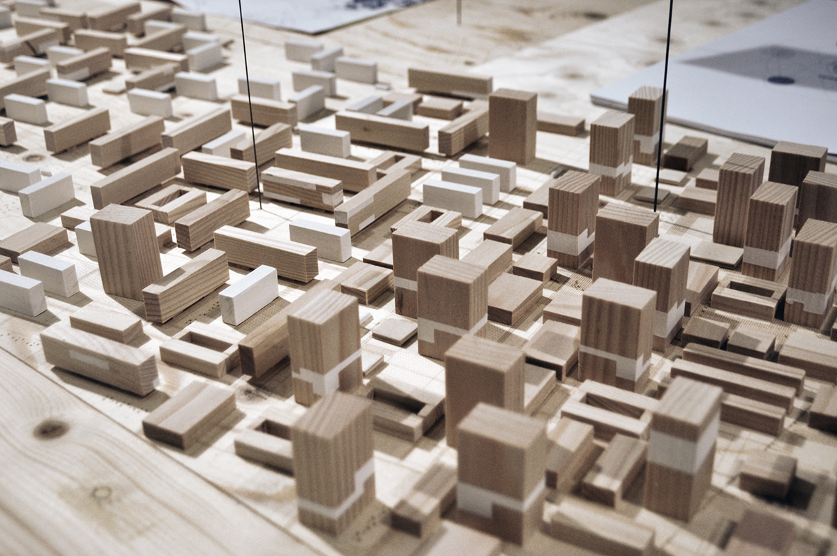
Urban layout

Introducing new agencies and economic models for Minha Casa Minha Vida
(the biggest social housing program in Brasil, shown in white) within existing and new urban fabric.
(the biggest social housing program in Brasil, shown in white) within existing and new urban fabric.
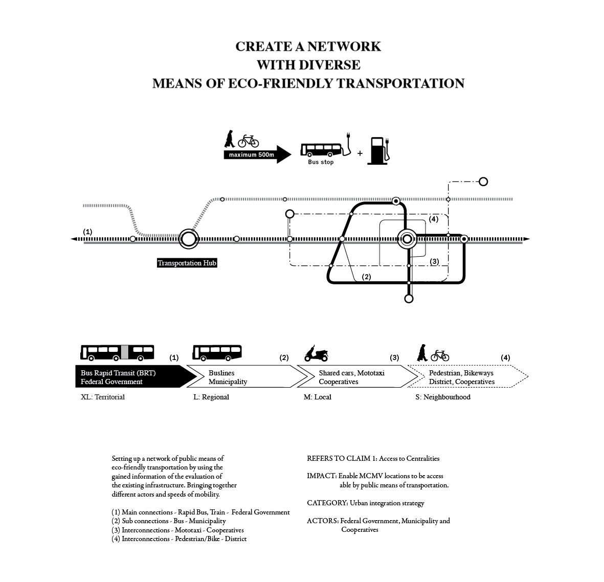
Only 20 minutes to Plano Piloto with an eco-friendly transportation system!
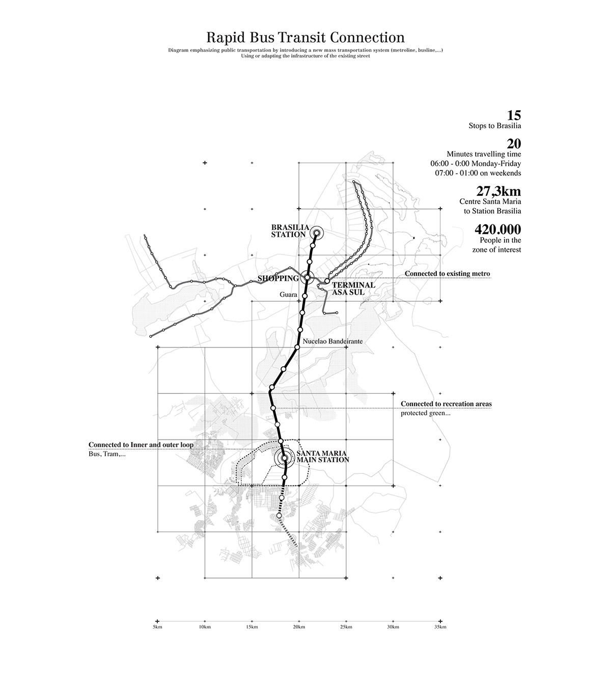
Emphasizing public transportation by introducing a new mass transportation system in a regional scale.
BRT - Bus Rapid Transport - using and adapting the infrastructure of the existing streets.
BRT - Bus Rapid Transport - using and adapting the infrastructure of the existing streets.
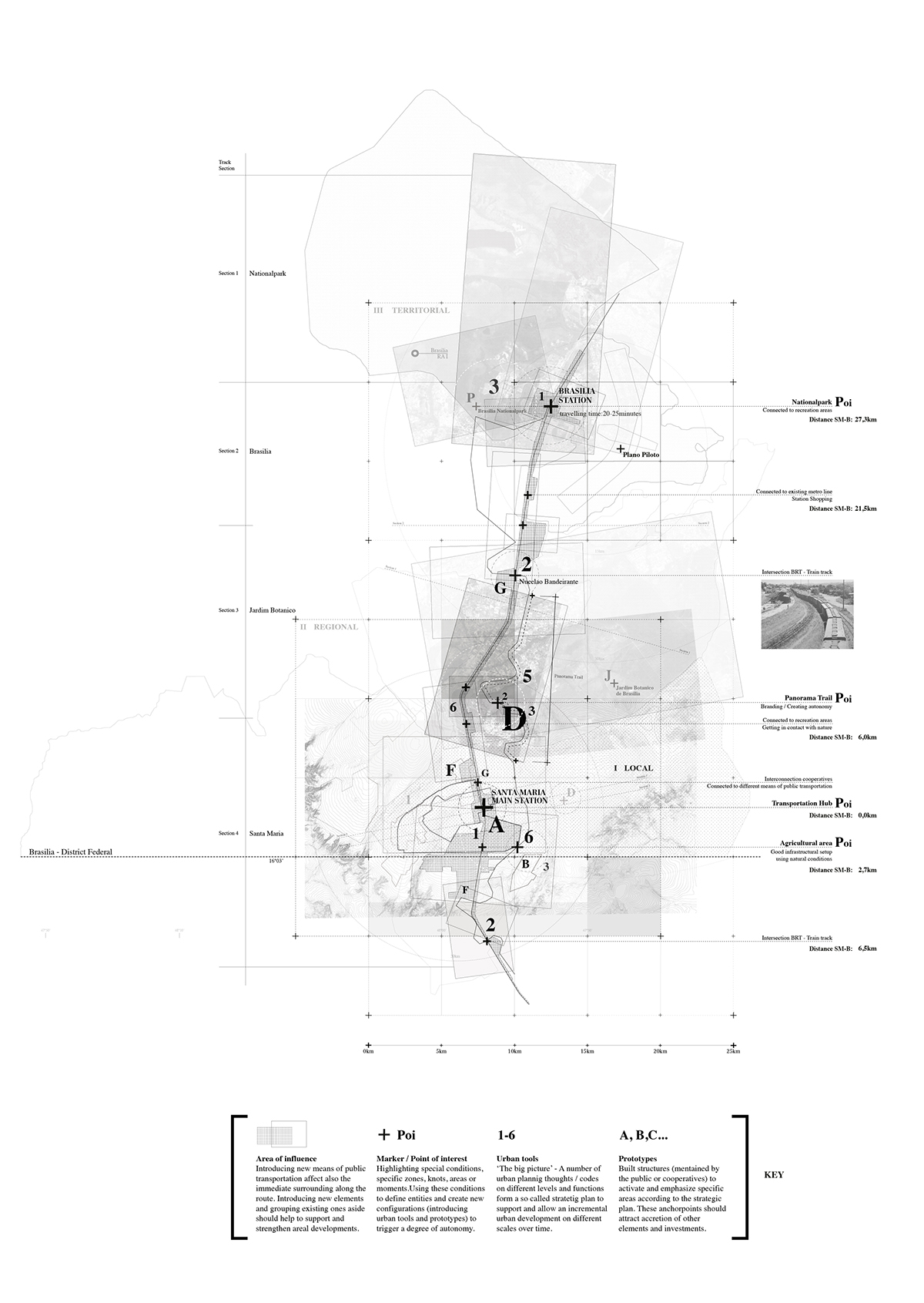
Map showing the area of influence and frames by introducing a new public transportation system.
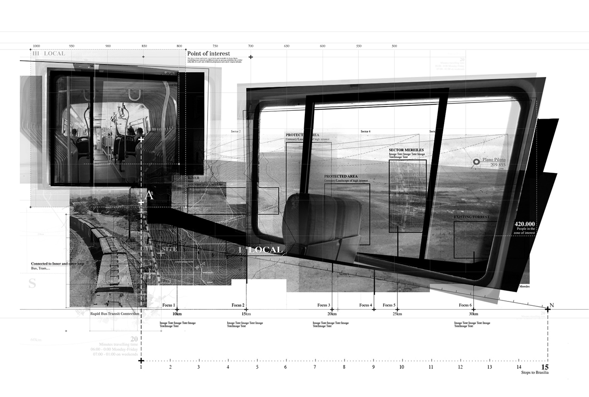
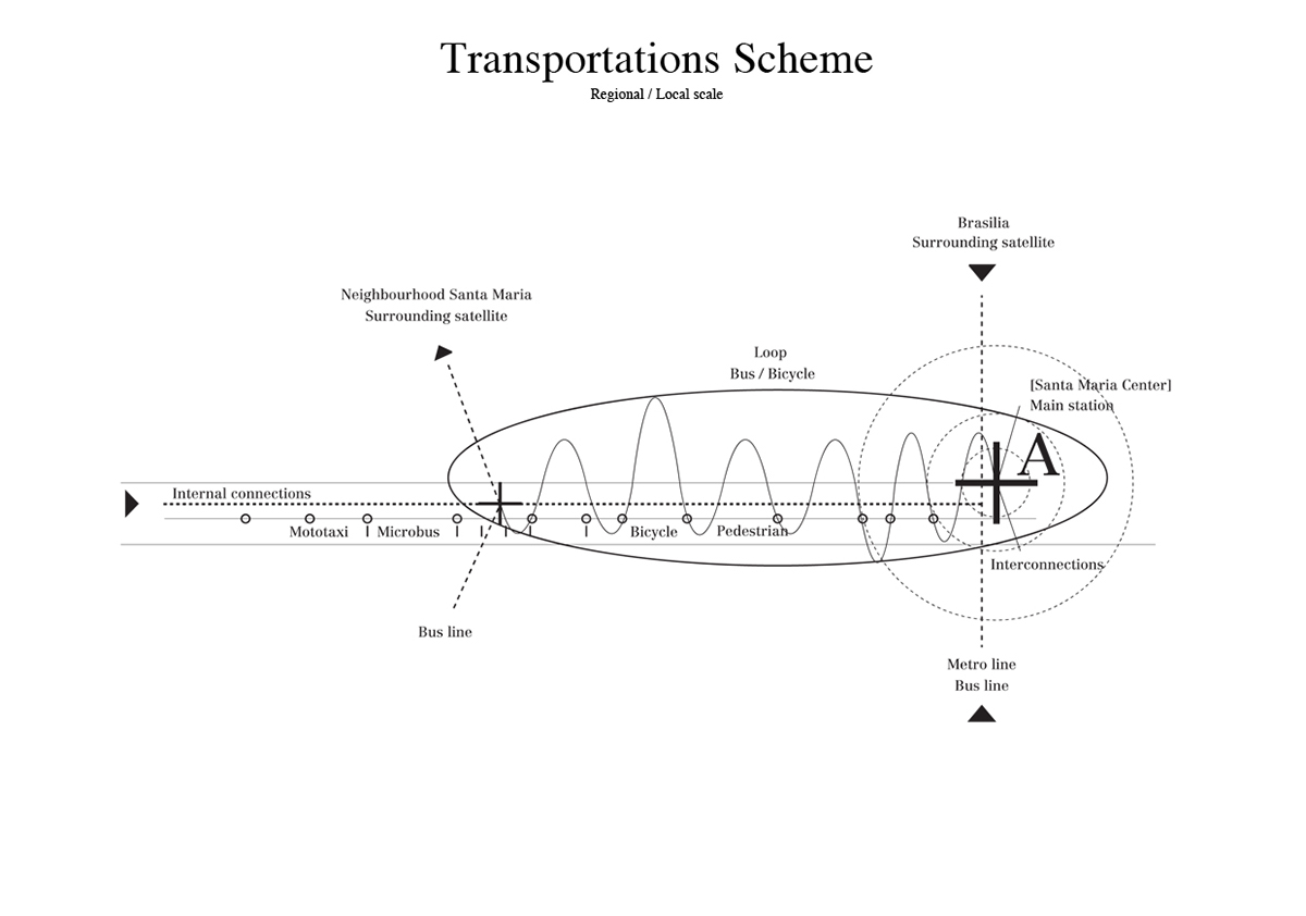
Atmospheric scheme on transportation systems within the area of interest.
Trying to catch the experience of the journey (from a user's point of view) and his relation between the transportation devices and the environment.
Relational and organisational mapping.
(Image inspired by the work of Mei Fang Liao and Diller and Scofidio + Renfro Case No. 00-17163 Fragment)
Using the method and mappings of representation for spatial propositions, potentials and relations for landscapes also
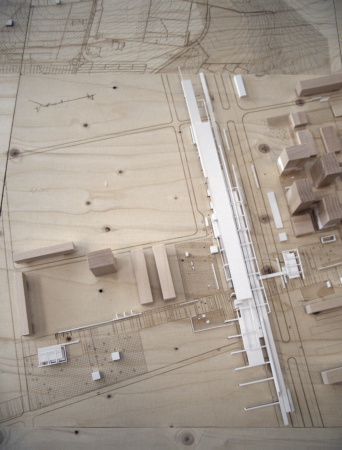
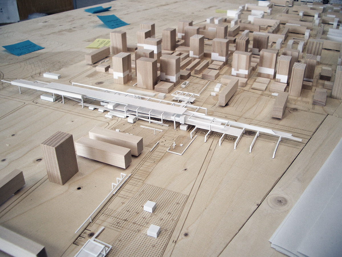
for setting up and organizing the building of the main station (infrastructural hub).
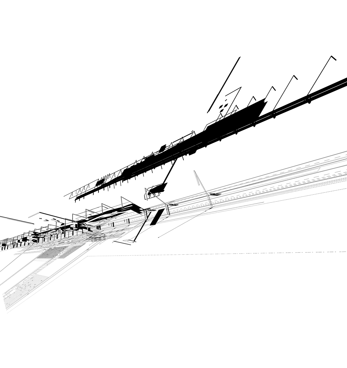
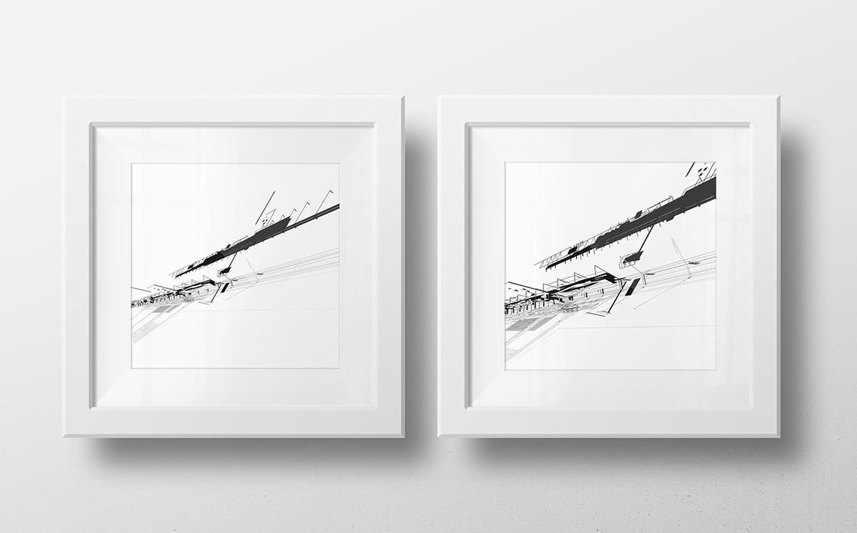
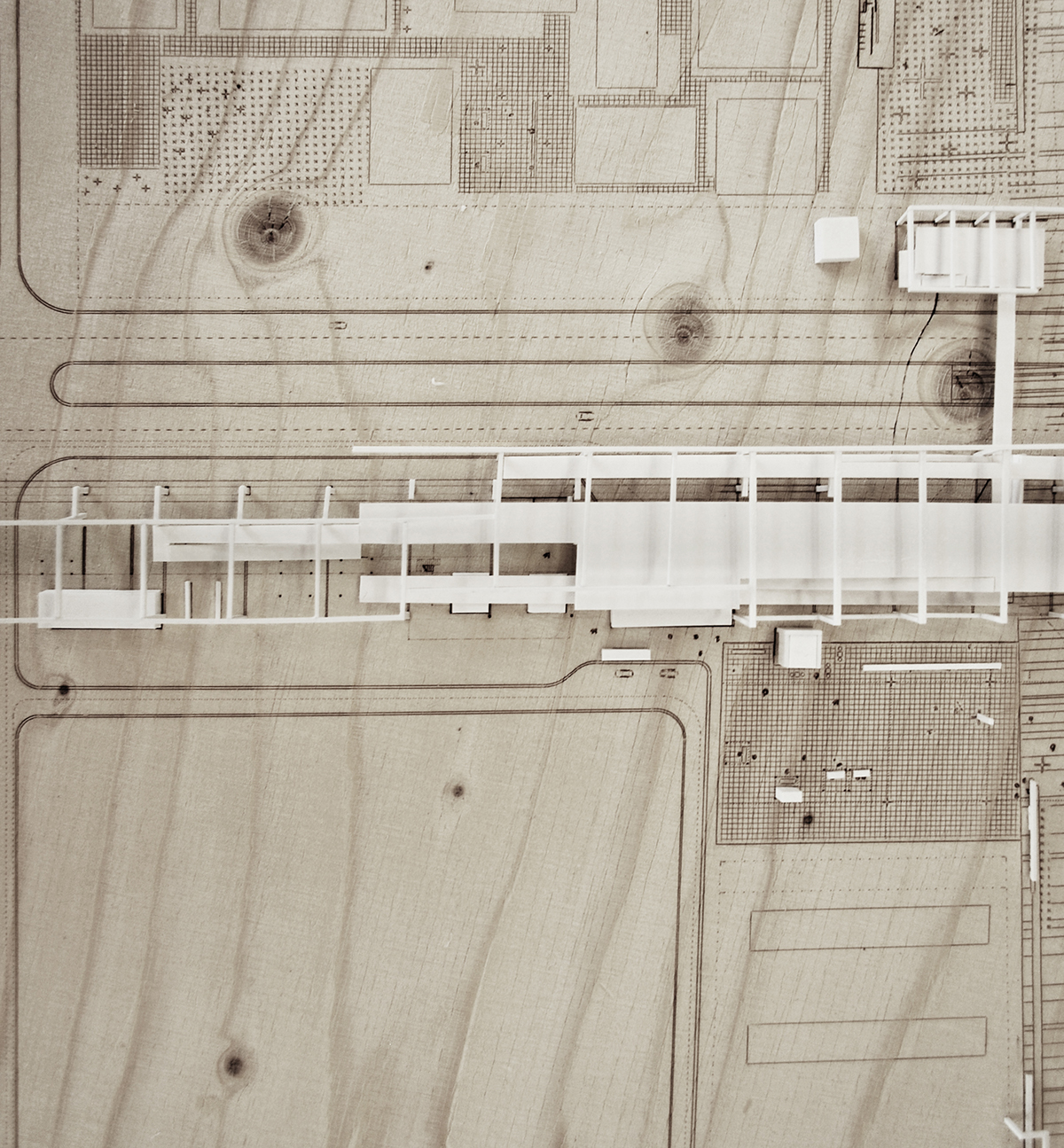
The building developed as topography and structure to support the needs on site than being an object of design.
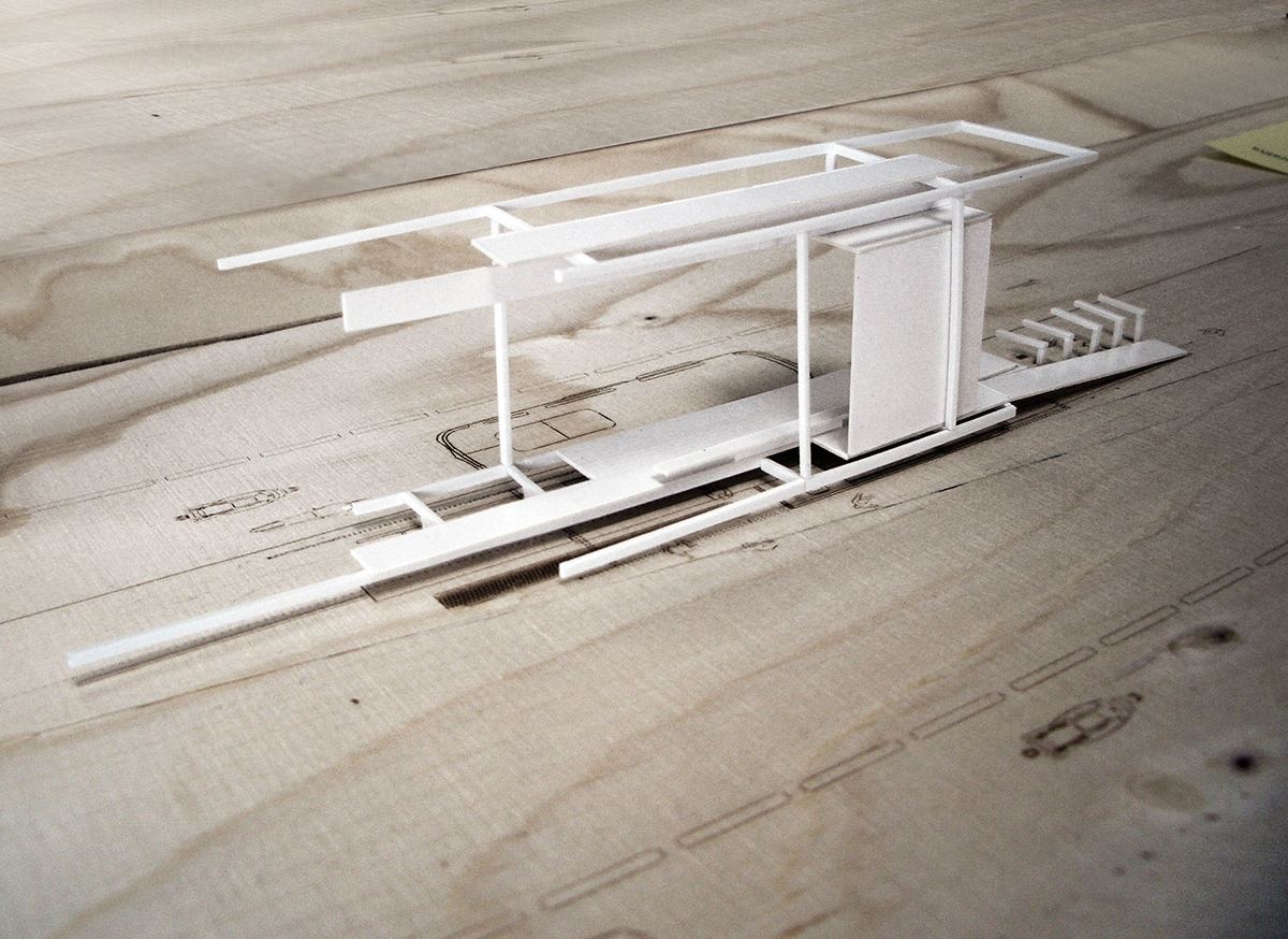
Plan and section shapes of the transportation hub
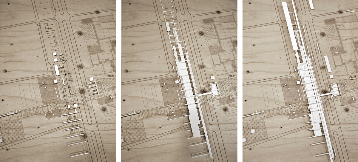

Collage Transportation Hub

Distribution / zoning of functions and areas
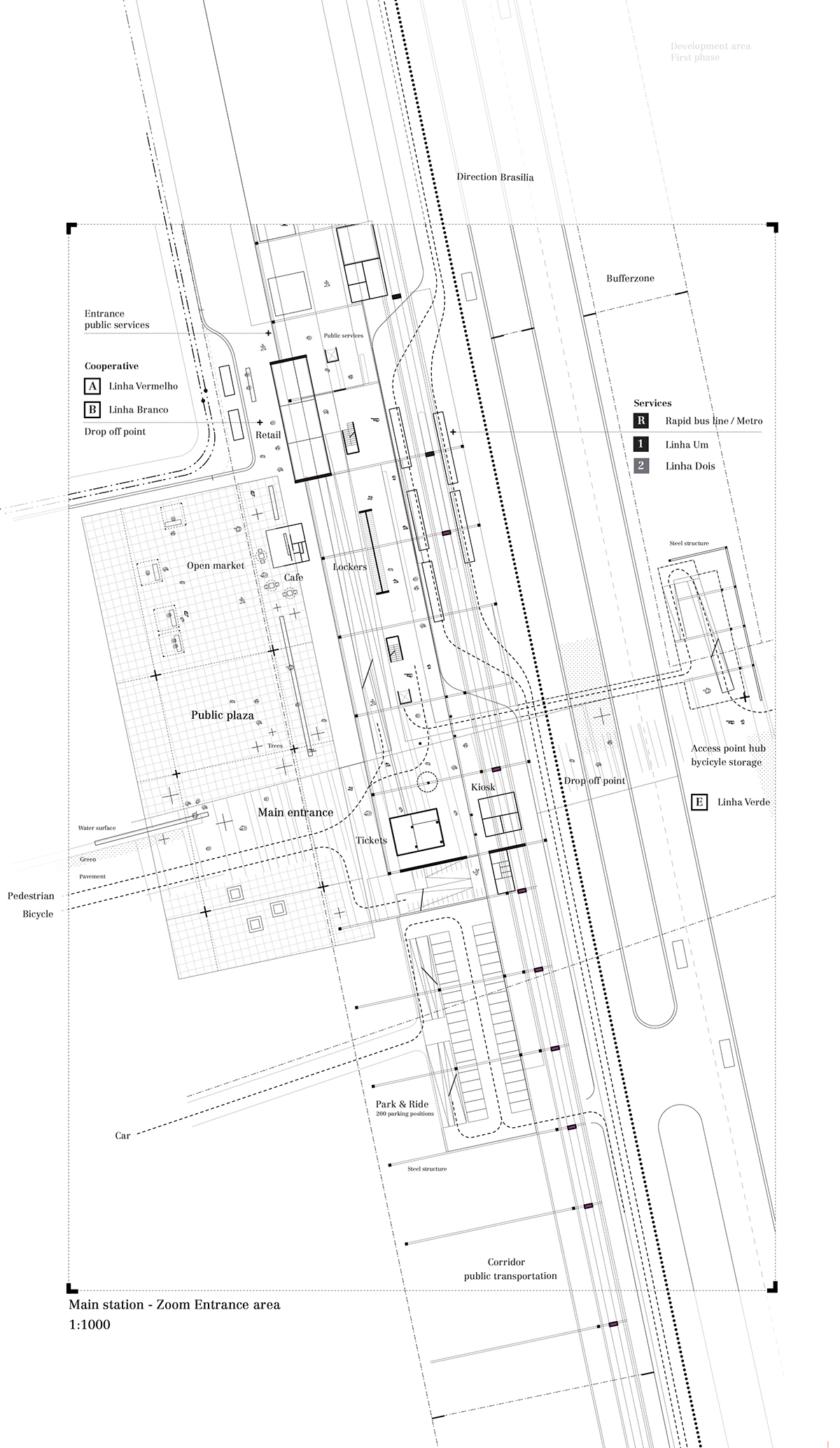
Together with a network of bus, bicycle and mototaxi stops, the 300 meter long structure, filled with volumes, ramps and ceilings according to its needs and possible expansion, forms the 'heart' of the new mobility setup for this area.

A new mobility map - bringing together different means of transportation
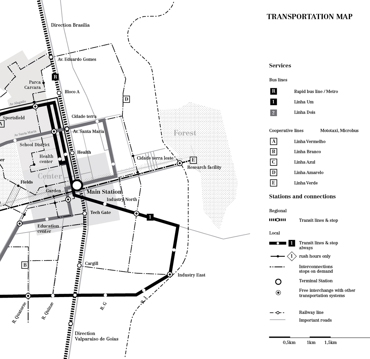
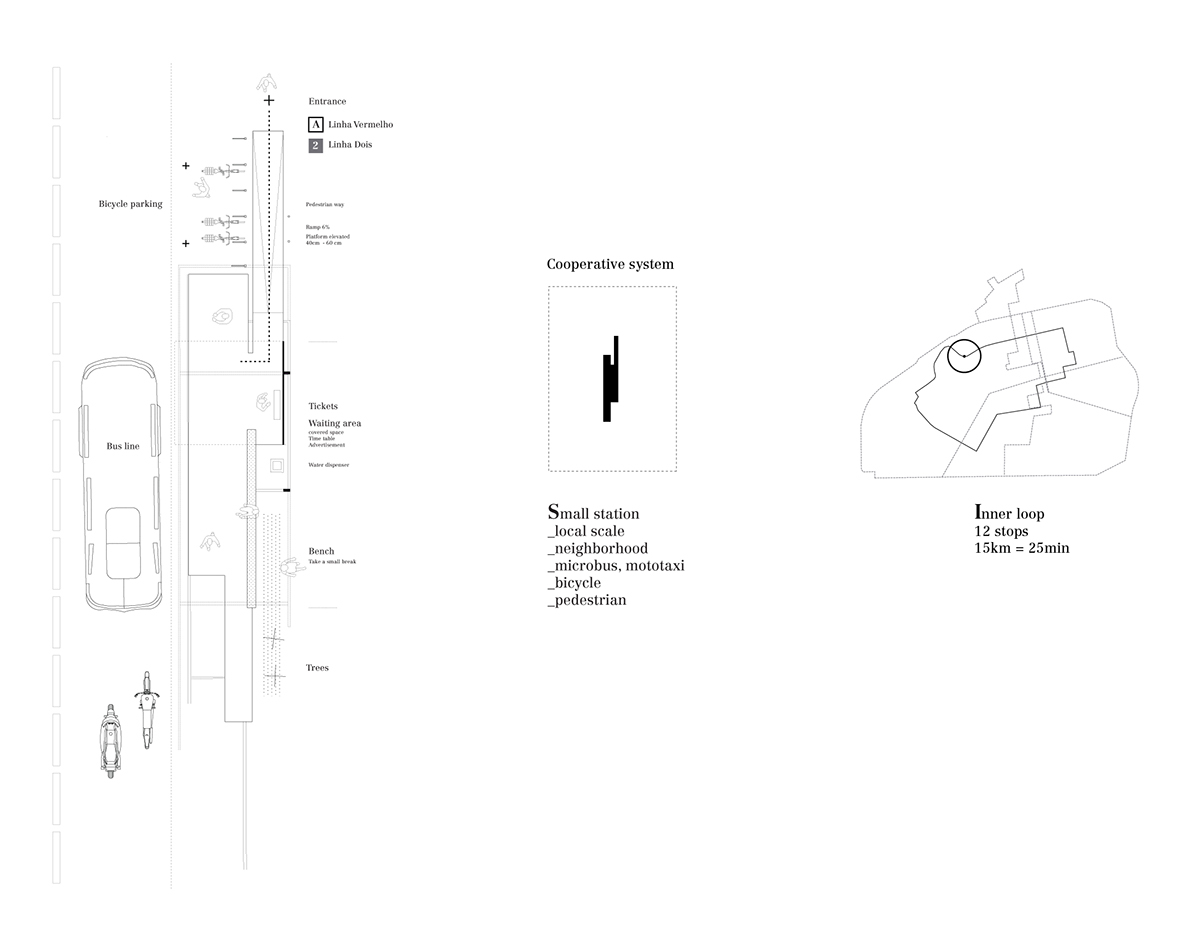
Drawings from left to right - bus stop, services/actors, location within the transportation network
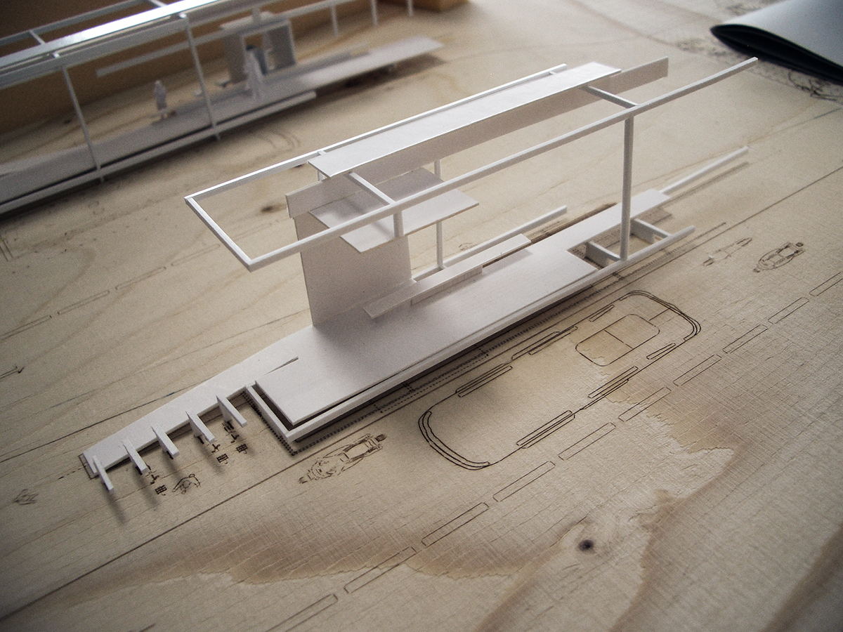
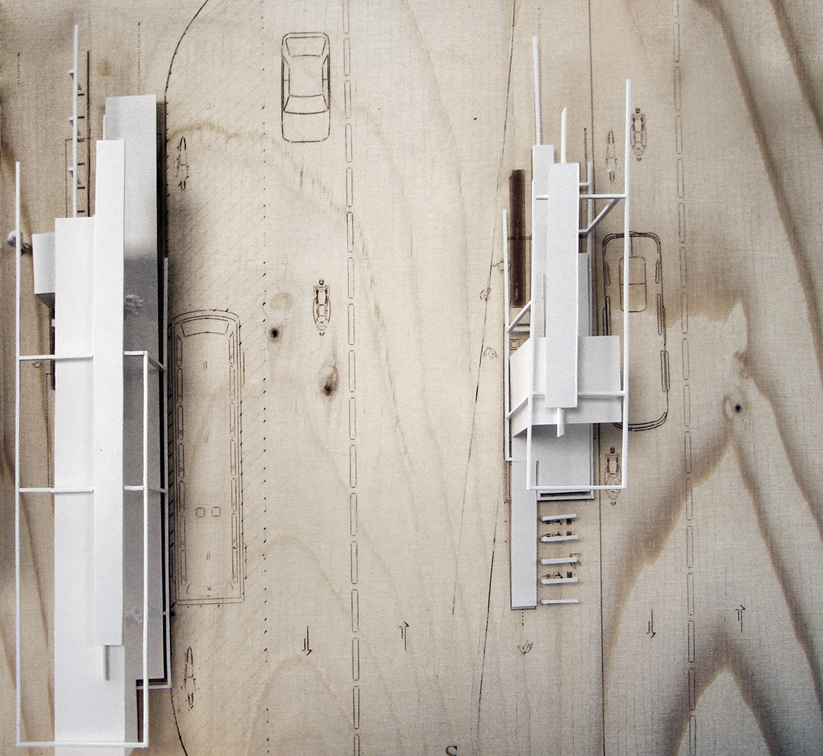
Small bus station - cooperative means of transport
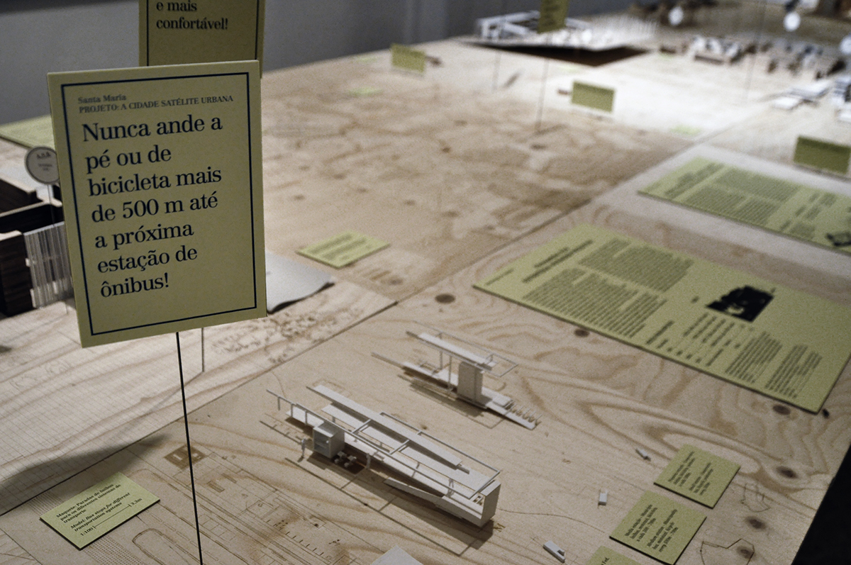
Project billboard
Exhibition 'Minha Casa, Nossa Cidade' at Studio X, Rio de Janeiro - June 2013
Exhibition 'Minha Casa, Nossa Cidade' at Studio X, Rio de Janeiro - June 2013
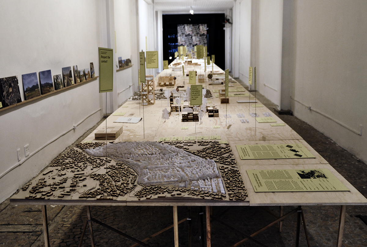
Exhibition 'Minha Casa, Nossa Cidade' at Studio X, Rio de Janeiro - June 2013
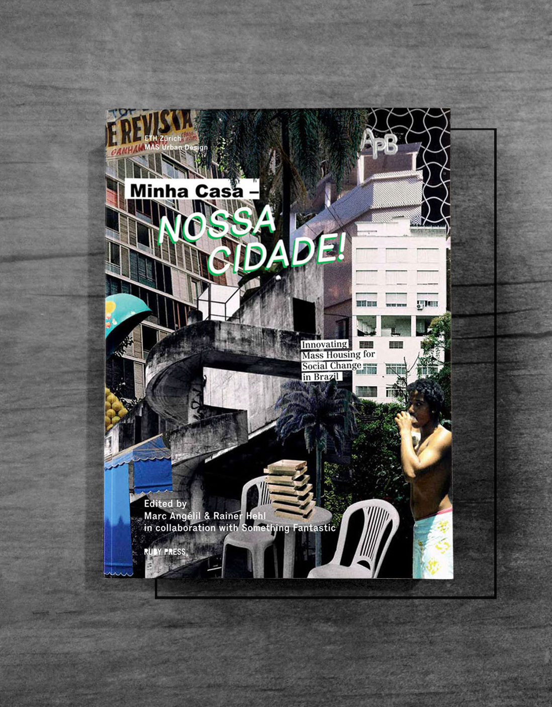
'Minha Casa, Nossa Cidade' - design proposal by the MAS Urban Design Program ETH Zürich, Publication by Ruby Press - May 2014
http://www.ruby-press.com/books/minha-casa-nossa-cidade
'What...is landscape?'...
'The land, the trees, roads, buildings, and man are regarded not as individual objects, ensembles of varied elements,
or classes of phenomena, but as superficial clues of underlying processes' (Meinig 1979:33-48)
...being featured within Part I of the book - Reading the landscape - 'What...is landscape?'
Asking questions of landscapes through design drawings.
An article by Ed Wall (Academic Leader Landscape, University of Greenwhich)

'The Routledge Handbook of Teaching Landscape' - Karsten Jørgensen, Elke Mertens, Richard Stiles, Nilgül Karadeniz
Publication by Taylor & Francis Ltd. - March 2019


